Monthly Archives: August 2013

Abol Bridge/Penobscot River

One year ago today my family laid Don to rest. Along with his good friends Steve and Mike, I had the privilege and honor to eulogize my brother at his memorial service. With a heavy heart I spoke of Don’s love of the outdoors. Of how he loved to fish and hunt and walk in the woods. I spoke of his love of baseball and how much he loved the Braves. I talked of how much he loved his family, and above all I spoke of his faith, especially in the last weeks of his life. Our family mourned Don’s death, but more importantly we celebrated the life of a truly good man. A good husband, a good father, a good son, and a good brother. On the one year anniversary of my brother’s service I hiked throughout the day with Don on my mind.

The one thing that I recall most vividly after Don’s diagnosis of ALS was how he regretted not having a disease he could fight. My brother never quit. His opponent just overwhelmed him. In some ways that’s what the Appalachian Trail has done to me. It has tested every physical muscle in my body. It has attempted to get in my head and invoke almost a mental torture. It has left me bruised, cut, scraped, battered, and so tired that I could hardly think. But unlike Don’s bout with ALS, The AT has given me the opportunity to fight back.

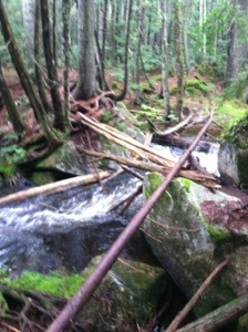
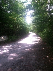
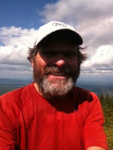
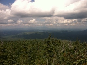
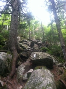
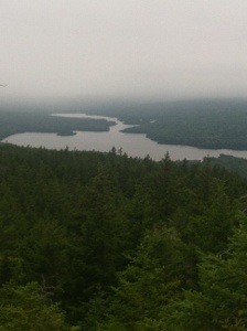
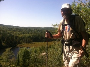
Today I think I made my peace with this trail that I’ve had a love/hate relationship with since I first stepped foot onto it. I promised myself at 7:00 this morning that I would enjoy hiking today whatever the trail had to offer. The AT rewarded me with about as agreeable a 17.2 miles as any I’ve confronted over the past several weeks. Sure, the rocks and roots and mud continued; however, I just took them in stride and focused on the bigger picture. For the past five months and eight days I have enjoyed a privilege that not many get. I’ve had the opportunity to spend each of those days with nature. Today I appreciated that opportunity.

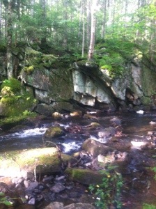
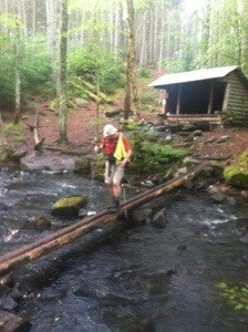
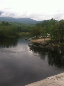
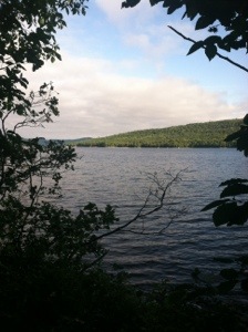
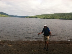
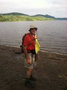
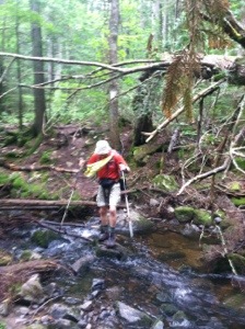
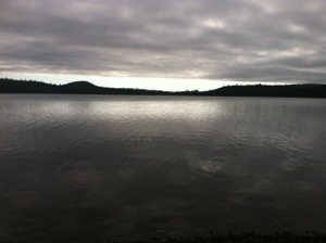
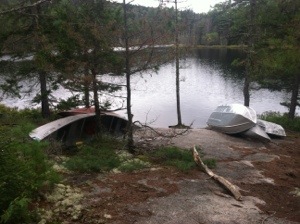
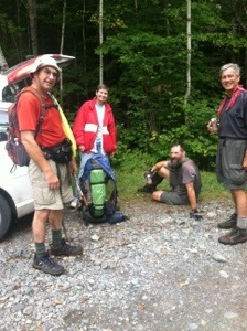
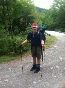
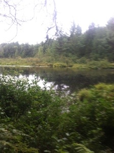
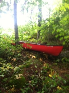
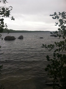
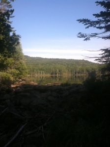
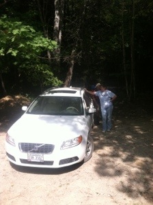
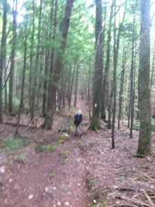
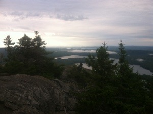
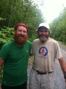
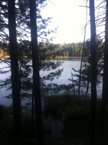
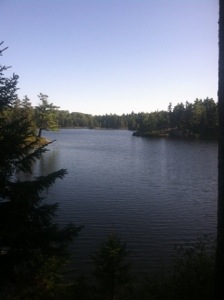
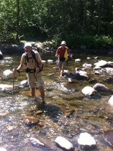
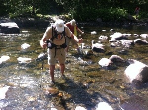
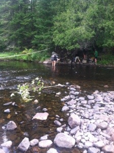
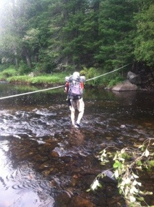
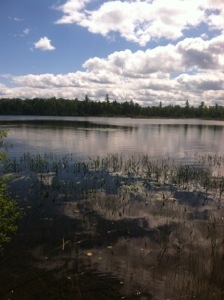
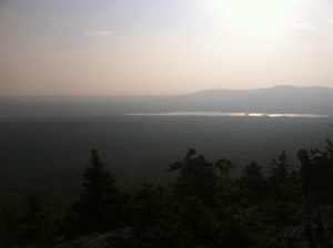
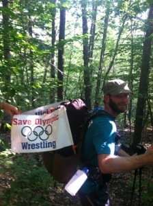
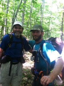
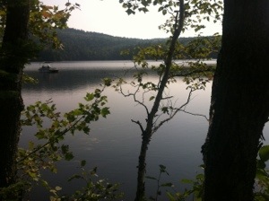
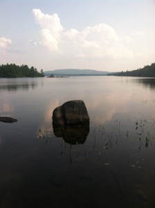
Molar Man and I hiked with a purpose today. We reached the Rainbow Stream Lean-to, a distance of 2.2 miles, in less than an hour. With confidence, I walked the log bridge across the stream and snapped MM’s pic as he made his way to the other side. That first hour set the tone for the remainder of the day. After the brief break at the shelter we didn’t stop again for almost four miles until we reached the Rainbow Lake Campsite. Some section hikers were breaking camp at the beautiful setting. The trail then continued to wind around the lake for a while. I looked over my left shoulder often, expecting to catch a glimpse of an isolated fisherman on a boat. None appeared.

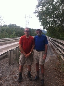
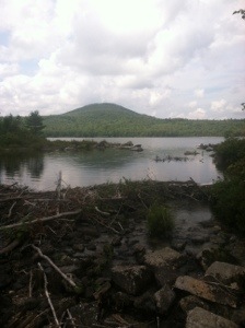
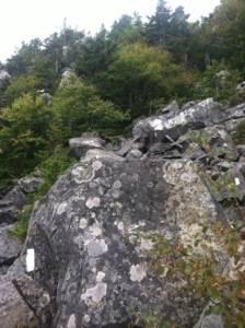
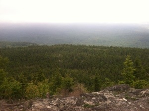
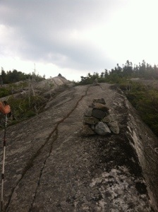
When the trail finally moved away from the lake, it elevated over 400 feet to Rainbow Ledges. With cloud cover in all directions, Molar Man and I had no views while we took a short lunch break. The climb up the ledges, over some almost level rock face, actually seemed easier hiking than over the roots and through the mud. We stopped again at the Hurd Brook Lean-to where Funnybone, Double Nickel, and Rich were also taking a break. They all plan to summit on Monday, so hopefully we can hike up together. From there Molar Man and I hiked strong, reaching the Golden Rd. before 2:30.

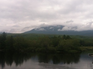
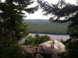
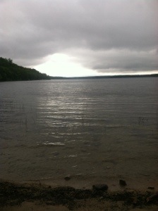
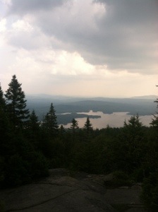
The AT turns right at the road and heads toward Abol Bridge. From the middle of the bridge we were treated to a view of Katahdin. Clouds rolled over the mountain as I paused to admire its enormity. Below in the Penobscot River a fisherman appeared to be fly fishing for trout. After crossing the river we passed a trading post on our way to the parking area where Sweet Tooth was waiting. From there it was back to Millinocket where the three of us will join Susquehanna Slim and his lovely wife for dinner tonight. It will be the first time I have seen Slim since he summited on Friday. For Molar Man and me that event will have to wait until Monday. Just two more days on the Appalachian Trail.

20130831-170545.jpg

20130831-170556.jpg

20130831-170638.jpg

20130831-170605.jpg

20130831-170647.jpg

20130831-170619.jpg

20130831-170629.jpg

Categories: AT Hike | 1 Comment

Pollywog Stream

With the four day countdown officially underway, Molar Man and I started today’s hike with a mere 8.7 miles planned. When one is slack packing the 100 Mile Wilderness, there are obviously limitations regarding the availability of roads. So today’s hike turned out to be a half day hike since we finished around noon. That gave us, along with Sweet Tooth, the remainder of the day to drive into Baxter State Park to check out the Katahdin Stream Campground. Now with all logistics in place, we just have to hike the final 27.2 leading up to summit day.

From the logging road where we ended yesterday, Molar Man and I started up a pretty level trail for the first mile. At Prentiss Brook we were able to rock hop across since yesterday’s raging waters had subsided. In fact, there would be no perilous water crossings today. Most of the water we saw was in Nahmakanta Lake early and later in Crescent Pond. Part of the trail along Namakanta Lake travelled along a sandy beach. Some pebbles mixed in with the sand, but it still made for fast walking.

After passing the lake we stopped briefly at the Wadleigh Stream Lean-to. Then we crossed another unnamed stream before beginning a climb of Nesuntabunt Mountain. Even though the ascent covered only 700 feet, it was steep. I told Molar Man that I supposed the trail was offering us one final practice climb before Katahdin. Unfortunately we were unable to see the Big K from the summit due to cloud cover. We did get a nice view of another pond. I’m not sure which it was.

As we descended the mountain there were a couple of other places where the lake was visible. After leveling off the trail almost circled Crescent Pond. At one point a small boat had been tied to a tree. At another a few other boats and a canoe lay near the bank. Still moose were not to be seen even though this pond looked like the perfect habitation. I paused by the boats for a few minutes to watch, listen, and reflect in the stillness of the picturesque setting. Quiet prevailed. From the pond we made our way along another body of water, Pollywog Stream, toward the logging road where Sweet Tooth was waiting.

At the car Double Nickel and Rich were enjoying some trail magic in the wilderness. Birdman also arrived to join us. I told Rich that I hoped we were on the summit together because I wanted to hear him play his trumpet. He said he definitely planned to play. As we drove up the logging road we also saw Bane’s dad, who had parked near a rushing, boulder-filled stream to take some photos. This may be called the 100 Mile Wilderness, but we sure have seen a lot of traffic over the past few days.

After a quick stop in Millinocket the three of us headed up to Baxter. All the rangers we spoke with were extremely helpful. They exhibited great patience since I imagine they have been asked the same questions many times. From the first ranger station we drove back into the campground and saw where the AT crosses on its way up Katahdin. I felt the excitement, knowing that I’m only three days away from walking up that path.

When we got back to the motel in Millinocket, I spotted Barking Spider and Stretch getting out of a car. Stretch introduced me to her dad, Peter, who had come to pick them up from Baltimore. Peter thoughtfully mentioned Don when he told me he had been reading my journal. Stretch and Barking Spider are two of the nicest young folks I’ve met on the trail. I congratulated both for summiting today. I have also seen others at the motel, that I had hiked with or around, who have now summited. Burning Man and Acunamatata were here Wednesday and I spoke with Torch and his dad yesterday. All were excited with their accomplishment and just to be finished. For me, however, there are still a few miles to be hiked. Early tomorrow Molar Man and I plan to hike our last big mileage day as we put ourselves in position for the last big climb on the Appalachian Trail.

20130830-203627.jpg

20130830-203638.jpg

20130830-203652.jpg

20130830-203710.jpg

20130830-203718.jpg

20130830-203727.jpg

20130830-203740.jpg

20130830-203756.jpg

20130830-203805.jpg

20130830-203816.jpg

20130830-203824.jpg

20130830-203833.jpg

Categories: AT Hike | 2 Comments

Somewhere in the Wilderness

If I had to use one word to describe today on the Appalachian Trail it would be “wet.” From light rain to wet slippery rocks, to wet slippery roots, to wet slippery mud, it was all wet. And as a result of a wet trail, by day’s end, I was a bit wet myself. Wet shoes, wet socks, wet fording shoes, and, to some degree, damp pants accompanied me throughout the later stages of today’s hike. After last night’s heavy rain many sections of the AT had become streams themselves. Other portions, quagmire-like, waited patiently to quickly turn a blue shoe black. All day there was “water, water, everywhere.”

For the first time in, well, I can’t remember when, Molar Man and I started the day not sure of where our final destination would be. We knew that Sweet Tooth would be parked at a road crossing the AT; however, it was uncertain to us whether the road crossed the trail at 12 miles or at 15. When we got to the Nahmakanta Stream Campsite and found no road, we realized we would be walking three more miles. Still we covered today’s distance in right at seven hours with two breaks. Considering the delays when we reached two water crossings, we made good time.

Like other recent days we passed several bodies of water. Mud Pond was the first. It looked like the perfect place for a moose to inhabit due to its swampy appearance. I stared in all directions but sited none. A little later the trail curled around the banks of Jo-Mary Lake for nearly a mile. A sandy beach area practically touched the trail. On a sunny warm day this would have been a great place for a swim. Even in the light rain, it seemed very peaceful. As Molar Man and I passed a ray of sunlight tried feebly to peek through the clouds.

Next we stopped at the Potaywadjo Lean-to for a short break. Rich and Double Nickel were there as well. The shelter’s roomy privy was about as nice as any I’ve seen on the AT. Complete with a window curtain and sky light, it also sported an interesting sign inside. “Latch door when leaving or porcupines will eat this building.” Funny, I haven’t seen one of those critters the entire hike. After leaving the shelter we passed Twitchell Brook, Pemadcook Lake and then Deer Brook. I already said it was a wet day.

The first major challenge of the day caught us by surprise when we reached Tumbledown Dick Stream. Listed in AWOL’s AT Guide as a ford, we did not anticipate what we found. Due to the excessive rain last night the stream had swollen to the point where there appeared to be no place to safely walk across. There were also no rocks above surface to hop. Molar Man walked about a hundred yards up stream to try to find a suitable place to cross without success. So reluctantly I followed my friend’s lead as he walked out over the rushing water on a blowdown to a boulder in the middle of the stream. From there he hoisted himself up on the rock and then positioned himself to gingerly slide on his pants across another blowdown. We didn’t take any action pics because I think we were both too petrified. I did get one of the spot after I was safely on the other side.

As I was crossing in the same manner as Molar Man, Birdman, an older section hiker, arrived at the stream. He followed me across and gratefully thanked me as I offered him a hand for the final step. The whole process was a bit unnerving. This trail just never lets up. On a day when it looks completely flat, it taunts us with swollen streams and relentless mud. The hiker can never win. We just have to try and compete. Thankfully, all three of us succeeded with the trial thrown at us today.

A little later we reached a branch of the Nahmakanta Stream which was fordable. Molar Man and I changed into our “water” shoes and easily walked across the narrow stream that was only ankle deep. On the opposite side metal steps were placed against the bank due to its steepness. While we were putting our hiking shoes back on Birdman showed up and just walked across in his boots. I suppose they were already wet, or maybe he didn’t carry fording shoes.

From the stream we hiked on through the puddles and mud to the pick-up location. I tripped on a root and fell during the final three miles. It was my second fall of the day. The other was on a slippery rock. That makes seven falls in the last three days. I’m trying to stay vertical. It’s just sometimes hard to do so. None of the falls have been serious. I’ve gotten up right away each time and have only bled once from a small scrap on my elbow.

So today was an OK day despite the trail conditions. After we reached Sweet Tooth we all drove up to Abol Bridge to check out day after tomorrow’s rendezvous point. On the drive up on Golden Rd. we were treated to an even closer look at a partially cloud covered Katahdin. The view gave me a little queasy feeling when I realized I would be climbing up that majestic mountain in a few days. The scouting trip proved successful as we found out all the details regarding checking in at the ranger station for our summit. From there we headed back to Millinocket where I’ve had a relaxing evening. Tomorrow it’s back to the wilderness where I hope to stay dry for just a little while longer on the Appalachian Trail.

20130829-202621.jpg

20130829-202650.jpg

20130829-202705.jpg

20130829-202726.jpg

20130829-202636.jpg

20130829-202759.jpg

20130829-202817.jpg

20130829-202740.jpg

Categories: AT Hike | 1 Comment

Jo-Mary Rd.

When I started this epic journey in March, my plan was to summit Katahdin on August 28, the first anniversary of my brother’s death. Those plans were not meant to be. I realized that I would need a little longer when I was back in New Hampshire. Two days ago I figured out why. August 26 and 27 last year were two of the most difficult days of Don’s life. Then one year ago today he was released from his agony. At 7:55, the time he was officially pronounced dead by a hospice nurse in his home, I stopped in the middle of the trail and said a prayer. And I felt my brother right there with me.

The past two days have been hard. I think they were supposed to be for a reason, just like so many things that have occurred on this hike. Not to in any way compare with Don’s last two days, but mine too have been challenging. I’ve tripped; I’ve fallen; I’ve bled; I’ve feared that my next step might lead to disaster. But through it all, I’m OK. Today all went well. For Don, one year ago today, he too was OK. His faith sustained him during those last agonizing days because he knew that soon he would be OK. With Don on my mind and his spirit by my side, I hiked strong throughout the day. As I walked today, everything was OK.

After a peaceful night’s sleep in the Logan Brook Lean-to, I awoke at 5:20 to see Molar Man already stirring. When my watch alarm sounded ten minutes later, I was stuffing my sleeping bag into its sack. A few minutes later All the Way roused himself and also began packing up. The one “young kid” in the shelter, 23 year old McJetpack, even stirred despite the early hour. I took an instant liking to the lad from a Chicago suburb when he arrived at the shelter last night. An affable fellow, he said this would be the earliest that he would be the last to leave. I told him I would see him up the trail as Molar Man and I headed for the white blazes at 6:04.

With an exceptionably agreeable trail, we hiked at a better than two miles an hour pace for the first four miles. A ford had been listed in the AT Guide at the East Branch of the Pleasant River; however, we were able to rock hop without difficulty. Shortly thereafter we began our only climb of the day, a 700 foot ascent up Little Boardman Mountain. Even though the little guy only stood at 1980 feet, the last 400 feet were steep. At the top we ran into Double Nickel and a section hiker, Rich from St. Simons, GA, who was completing a section hike he started back in 1979. Now that’s perseverance. Rich carries a trumpet which he plays every night. Kind of made me think of Gabriel.

After Little Boardman the trail became (to quote Slim) “a walk in the park.” Sure there were a few rocks and roots, and some boggy areas with board walks, but mainly it was a fast path. At the Cooper Brook Falls Lean-to we stopped for lunch. McJetpack was also there. Since I won’t be staying in the woods anymore I offered him a salmon packet. He graciously accepted and then filled my water bottle from the brook for me. As Molar Man and I returned to the trail for 3.7 more miles, Goose and All the Way showed up. I’ve been around them regularly now since early in New Hampshire.

Those final short miles of the day sped by. In fact, the whole day did. On the gentlest trail I’ve seen in weeks, we knocked out 15.4 miles in seven hours, thirteen minutes. At Jo-Mary Rd. Sweet Tooth was waiting. She said she had just provided some trail magic for McJetpack before we arrived. Who says this is a 100 mile wilderness? It did, however, take us 35 minutes on the logging road to reach the main highway. From there we made our way to Millinocket. So tonight I’m in a motel. Tomorrow and the three days thereafter, Molar Man and I will return to the AT to slackpack the remainder of the trail.

Today turned out to be a good day to hike. I passed two good fishing ponds on this day especially dedicated to Don. He would have liked them both. I smiled as I thought about memories we shared. I became emotional when I thought about our baseball conversations that are no more. I regretted that he is missing the Braves’ successful season. I thought about Lisa and Brent and how much they miss a kind and loving husband and dad. But most of all I was grateful as I hiked for Don’s life and for his faith. My brother is OK and I will be too as I hammer out 56.0 more miles on the Appalachian Trail.

20130828-183204.jpg

20130828-183213.jpg

20130828-183222.jpg

20130828-183239.jpg

20130828-183230.jpg

don_largebass


Don with a large mouth bass

donlisa


Lisa and Don – September 2011

Categories: AT Hike | 4 Comments

Logan Brook Lean-to

Molar Man and I just rolled into the Logan Brook Lean-to after another day filled with ups and downs. We had thought about moving on to the next shelter; however, we are both tired. So after only 12.8 miles we have called it a day. As I sit on a mossy rock about three feet off the trail heading north from the shelter, I am being serenaded by Logan Brook. Running only about twenty yards from the front of the shelter, the brook will provide my water source as well as offer a pleasing sound throughout the evening. This setting is quite nice in all respects.

Our day began at 7:20 with an immediate ford of the West Branch of the Pleasant River. Molar Man and I both managed to get across without a problem even though the ford is listed in the AT Guide as having a slick, rocky bottom. It was the widest ford that we’ve encountered. After the river we began a long gradual ascent of over 1600 feet up Gulf Hagas Mountain. About the final half mile was steep. From there we briefly descended before climbing up to West Peak at 3178 feet. Neither of these mountains offered a view. After another descent we next climbed Hay Mountain with the same result.

From the beginning of the hike today, I promised myself that I would attempt to hike with a more positive attitude. Even though I fell three times on slippery rocks, none resulted in any blood loss. I apologized to the trail and promised not to be too critical of what it throws at me. That was just before one of the falls. It didn’t matter. I wanted to at least try to befriend the trail again. Hopefully the old guy has forgiven me for hating him yesterday.

The highlight of the day definitely came at the summit of White Cap Mountain. Panoramic views on a beautiful afternoon made the tough climb worthwhile. Then on the rocky descent we were greeted with our first view of Katahdin, majestically appearing 72 miles in the distance. As I descended I alternated looking down in an effort not to fall and staring at the Big K, transfixed against a blue sky surrounded by puffy white clouds. I looked in awe at the mountain I’ll be confronted with in a few days.

So tonight should be the last I spend in the woods. Molar Man and I plan to move into Millinocket tomorrow afternoon and slackpack the remainder of the trail with Sweet Tooth’s assistance. I’m definitely ready for the hike to end. I’m about as physically and mentally depleted as I can ever remember being at any time in my life. This journey has challenged me in so many ways. The mental aspect has by far been my greatest challenge.

So as I prepare to spend my last night in a shelter, I’m thinking about one year ago tonight. That was my brother’s last night on Earth. Don knew, like I knew, that his death was near. Lisa and I tried to make him comfortable, but our efforts were to little avail. The Braves game was on in the background, but in his depleted state, Don couldn’t even enjoy his beloved team.

This trail has been hard, but my difficulties pale exponentially to how hard Don’s existence was over those last few weeks and at its end. So as I lie in the shelter tonight, in the woods that Don loved, I’ll remember my brother. I’ll think about our last night together, but more importantly, I’ll think about all the good times we shared. Tomorrow there’s a hike to be continued. 71.4 miles remaining on the Appalachian Trail.

20130827-170851.jpg

20130827-170925.jpg

20130827-170952.jpg

20130827-170915.jpg

20130827-170941.jpg

Categories: AT Hike | 1 Comment

West Branch Pleasant River

This constitutes the second opening paragraph that I have constructed today. I decided to trash the first due to negative attitudinal content. It began with the statement, “I hate this trail.” That’s exactly how I felt much of the day. In the other opening, however, I proceeded to go into a tirade over my frustration with all the obstacles the AT keeps throwing in my direction. I’m no different from any other hiker. Everyone who steps foot on this oftentimes brutal “footpath” faces the very same trail conditions. So I deleted the draft that made me sound like a whiner. Regardless, today’s trail was no fun. It aggravated me from the first climb, taunted me with a smooth surface for about ten yards, laughed, and tossed a nostalgic “White Mountain-like descent at me near the end of the day. Sometimes, and I did say sometimes, I hate this trail.

The AT set the mood for today’s hike early when it placed a root in a position for my foot to snag. Before I had shed my rain jacket, I found myself face down in the dirt. Fortunately my head didn’t hit. My hands saved me. Still the fall from the trip on the root established a irritable attitude that, for whatever reason, I embraced throughout the day. Today’s hike was hard. I wasn’t looking for hard. I wanted the path to return. After all we are in the 100 Mile Wilderness, which I thought was supposed to be known for its fast terrain. Maybe the young folks are able to whiz right through, but this old body needed nine hours to cover the 15.0 miles.

The first challenge occurred on Barren Mountain. Molar Man and I started the day at a pretty good pace, arriving at the summit in under two hours after a 1600 foot ascent over just under three miles. Like other days and climbs, roots, rocks, and mud all made their presence known. What I had not expected was the need to use my hands a few times to pull myself up a rock face or balance myself by holding to a tree. With four more mountains still to be climbed, I was already bordering on exhaustion after the first. The 4:30 alarm might have also been a factor regarding my early fatigue.

After descending Barren Mountain we were confronted with Fourth Mountain. I’m always a bit leery of these “unnamed mountains.” Not only was Fourth another tough climb, but on the way up Molar Man and I had to deal with Fourth Mountain bog. A board walk helped us with that. From Fourth Mountain we moved to Third Mountain. I suggested to Molar Man that we name the two Joe and Henry respectively. He failed to see the humor. At least the climb up to Monument Cliff on Third Mountain wasn’t quite so steep.

After Third we came to my favorite mountain of the day. After almost a 500 foot ascent, we reached the peak of Columbus Mountain. Finally, after hiking 2100 miles, I have discovered in Maine a mountain that shares its name with my home town. I took a picture of the sign designating its name and elevation before starting another descent to the Chairback Gap Lean-to. The only northbound thru hiker we had seen all day, Sleeping Beauty, was taking a break there. SB agreed that the trail had been tough today.

From the lean-to we only had to climb 200 feet to the summit of Chairback Mountain. Despite some rock slabs, the climb wasn’t too bad. The descent, however, was downright treacherous. Slim even sent me a text warning. For about a tenth of a mile I thought I was back in the Whites. A very dangerous,
steep rocky trail forced me to hike with deliberation again. On more than one occasion I sat down to inch my way down a rock slab. It was tedious.

When we finally reached some dirt trail, we were able to hike at a faster pace all the way to the Katahdin Ironworks Rd. Sweet Tooth had arrived earlier and was offering some trail magic to Sleeping Beauty and a section hiker. Another north bound thru hiker that I had not met, Triceratops, also showed up. Sweet Tooth said that SB had already warned her about my irritability. I acknowledged it before dropping my pack to hike another half mile to the West Branch of the Pleasant River packless. Molar Man followed suit. Sweet Tooth drove up the road to meet us for the ride into Milo.

Tonight we are staying at a B &B in the home of Everett and Frieda Cook. A more delightful couple I have not met in Maine. When we arrived one of their great-granddaughters was over for a visit. For a while I worked on my journal sitting on a front porch bench swing until the mosquitoes forced me inside. I plan to get to bed earlier tonight because Molar Man and I have a bigger day planned for tomorrow. With a tired body and weakened knees, I hope to hike with a more positive attitude as I continue moving through Maine on the Appalachian Trail.

20130826-202910.jpg

20130826-202922.jpg

20130826-202932.jpg

20130826-202941.jpg

20130826-202955.jpg

20130826-203004.jpg

20130826-203014.jpg

Categories: AT Hike | 2 Comments

Trail to Otter Pond Parking

When I think of the 100 Mile Wilderness, the final lengthy stretch on the Appalachian Trail between Monson and Millinocket, Maine, an old Cat Stevens song comes to mind. “Miles from nowhere, I guess I’ll take my time, Oh yeah, to reach there.” Right now that’s what I’m planning to do—take my time. Some people zip through the wilderness in five days. Molar Man and I plan to take eight. That will put us in position for a summit date of September 2 or 3, hopefully. Today we walked into the “wilderness” at 7:20 and hiked 15.3 miles plus an additional 0.8 on a side trail to the Otter Pond parking area where Sweet Tooth was waiting.

From the outset the trail today didn’t look any different from other sections of trail we have hiked. Ups, downs, rocks, roots, mud, rock slabs, jagged rocks, more roots, blowdowns, streams to rock hop across, streams to ford, ups, downs, more roots, more rocks……need I say more. Ponds again made their presence known as well. There was Spectacle Pond, Bell Pond, Lily Pond, North Pond, and Mud Pond. Not to be outdone were the brooks. James Brook, Thompson Brook, and Wilber Brook required crossings. Then there were the streams. Little Wilson Stream, Big Wilson Stream, Vaughn Stream, and Long Pond Stream gave Molar Man and me ample opportunity for rock hops and fords.

If my brother had ever hiked this section of trail, it would have taken him a week to cover the 15.3 miles. He would have gotten himself a Maine fishing license and made a stop at each pond. Don loved the woods, but he loved fishing more. I have no clue what kind of fish might have been swimming in those ponds, but Don would have figured it out and known what lures to use for a big catch. I paused to think about my brother and take a photo at each of the ponds I passed today.

Sometime around mid-morning I noticed a familiar hiker up the trail. Funnybone, who I hadn’t seen since Salisbury, CT, was engaged in a conversation with Molar Man. He hiked along with us for awhile until we stopped for lunch. Yesterday we happened upon our first McDonalds since Gorham in Foxcroft, so I decided to bring along a double cheeseburger for lunch. I also carried a coke to make my first meal in the 100 Mile Wilderness a memorable one. Mountain Goat and Klutz walked by as MM and I ate. Klutz smiled her cute smile and said, “Mickey D’s.” Mountain goat asked, “Where did you find that?” They both good-naturedly laughed at the old guy with a burger on the trail.

About the time we finished lunch two sections hikers stopped to chat. Steve and his teenage son Sam were out to do the wilderness. They sported some mighty large packs, telling MM and me that they just couldn’t figure out what to leave behind. Steve said he had climbed Katahdin years ago, so I quizzed him a little regarding some concerns I have. He offered some appreciated positive assurance that I could make it. Later in the day I would see Steve slip from a rock and be in Big Wilson Stream almost to his waist. Sam had managed to stay dry on the rock hop.

Late in the afternoon Molar Man and I both tired. We had begun the day strong after yesterday’s rest; however, all the ups and downs kind of tuckered us both out. At the final water crossing, Long Pond Stream, Molar Man somehow figured out a passage across using rocks. Some in fact were submerged. I chose to ford after almost slipping in from a rock in the rushing waters. According to the AT Guide there are only three fords remaining. Thus far none have caused any real challenges. I just take my time, use my trekking poles for balance, and make sure I have a solid plant before taking the next step.

After what seemed like a long tiring day, Molar Man and I finally reached the blue blazed trail to the Long Pond Stream Lean-to. Two-tenths of a mile past the turn to the shelter we located the unmarked side trail to the Otter Pond Parking area. A little apprehensive since we weren’t positive that the trail we had taken was the right one, we hiked quickly, hoping that it was. When the white Volvo came into sight, we were two relieved, happy hikers. Within minutes we were on our way back to Greenville.

Tomorrow will offer us a day with more elevation, five mountains to climb, and several views. Molar Man suggested a very early start and I agreed. So a little after sunup we’ll once again be “Miles from nowhere,” as we make our way to “the mountain I have to climb” in the wilderness of Maine on the Appalachian Trail.

20130825-213557.jpg

20130825-213606.jpg

20130825-213615.jpg

20130825-213625.jpg

20130825-213637.jpg

20130825-213651.jpg

20130825-213706.jpg

20130825-213715.jpg

20130825-213726.jpg

Categories: AT Hike | Leave a comment

Resting in Maine

I’m in the back seat of the white Volvo station wagon with Ohio plates. On a beautiful 50 degree sunny Maine morning Molar Man, Sweet Tooth, and I are on a scouting expedition of sorts. It would have been a perfect day to hike; however, we both needed a day off. It’s the first for me in three weeks. For Molar Man it has been over a month. Our bodies are grateful for the respite. We need fresh legs for the final push. Strangely, I’m starting to feel a little sad that the adventure is about to come to an end. Did I really just write that?

From Monson, ME to Millinocket is referred to as the 100 Mile Wilderness mainly because there are no towns between the two. Roads do exist in the wilderness; however, they are remote. If one hopes to navigate them effectively it helps to have a reliable atlas and a GPS. Molar Man has both, so we not only found all the roads today, but we devised a strategy to hike the entire wilderness with only one night in the woods. The DBM (or maybe it should be changed to the MMM) is in full swing for the remainder of Maine.

The three of us first located a road that leads to the Otter Pond parking area where we plan to end a 15.3 mile day tomorrow. From there we moved on to the more easily accessible Katahdin Ironworks Rd. where the AT also crosses. The downside to this route is that a $12 fee per person is charged for access to the logging road. Folks using this road must stop and pay at a checkpoint where an old iron smelting community existed in the 1800’s. $12 a person seemed kind of exorbitant, but then again, it is private land. The fee also allowed us into the other logging road, Joe-Mary, so at least we got two for one. When Sweet Tooth picks us up on these roads, only she will have to pay.

When lunch time rolled around we stopped at a small town America general store for a burger. The establishment sported an inventory that included everything from bread to homemade canned goods to fishing lures. A wide assortment of adult beverages were arranged nicely behind the counter. The lady at the check out called every customer who entered while we were there by first name. I’ve been very impressed with all the friendly folks in Maine. It truly seems that their sincerity is genuine. That is a trait this southern man appreciates.

After the lunch stop we began the trek up Jo-Mary in search of two additional AT access points. The lady at the Jo-Mary gate offered highlighted maps and solid information regarding our destination. Still, the gravel roads with crudely constructed signs posed some difficulty in finding the AT crossings. Nevertheless, displaying a goodly amount of patience, we managed to locate the trail in two strategic places. After the successful reconnoissance, we headed back to Greenville.

So with a plan in place for the 100 Mile Wilderness, Molar Man and I hope to reach Baxter next Sunday after spending only one more night in the woods. If all goes according to plans, we will summit on Labor Day. Our backup plan is a Tuesday climb. Either way, as my grandmama used to say, “Good Lord willing and the creek don’t rise,” there’s only a little over a week remaining on the Appalachian Trail.

20130824-210834.jpg

20130824-210848.jpg

20130824-210858.jpg

20130824-210907.jpg

20130824-210916.jpg

20130824-210925.jpg

Categories: AT Hike | 1 Comment

ME 15, Monson, ME

Five months ago today I signed in at Springer Mountain and began my walk north to Maine. At times it feels more like five years. I’ve said before that time is irrelevant on the AT. Sometimes I don’t even know what day of the week it is. At others the whole experience seems more like a dream. Have I actually hiked 2071.4 miles? Do I only need to hike 114.5 more miles to complete a thru hike of the Appalachian Trail? The answer is “yes” to both questions and I’m getting pretty excited about it. Still, there’s hiking yet to be done, and to be perfectly honest, I’m tired. So tomorrow I’m going to take one final day off to rest up for the 100 mile wilderness and Katahdin.

Today started like most when I’ve spent the night in a shelter. At first light I packed up quickly and started up the trail with Molar Man at 6:20. Due to last night’s rain, mud made its presence known again today. And in addition to the mud, streams and rivers were at higher levels. As a result of these higher levels of water, I got the opportunity to do my first fording today. One took place at a stream while the other two occurred at the West Branch and the East Branch of the Piscataquis River. All went smoothly.

I must admit that I have been somewhat apprehensive over fording for some time. Today’s events, however, alleviated any fears. When I arrived at the first stream I removed my trail runners and socks and the put on my Vivobarefoot camp shoes. The flexibility of the plastic shoes made the crossings seem easy. At the West Branch of the Piscataquis, Goose and All the Way had arrived just before Molar Man and me, so I watched as they made their way across the wider river. A rope was affixed to trees on each side for balance. The water only came up to mid calf at the deepest part.

The third and final ford occurred at the East Branch of the Piscataquis River. Even though the river was wider, the depth of water was about the same as the second crossing. Again I easily made my way across. On the other side MM and I sat on a couple of rocks and had lunch. While dining we watched Sleeping Beauty and Jesse cross using the rock hop approach. They only got a little wet. Since we were ready to move on, they took our rocks for their lunch. We would see no other north bounders throughout the afternoon; however, we did meet Fifteen who was walking south on a flip flop.

As the afternoon waned Molar Man and I both struggled to keep any momentum. I believe I felt sluggish due to poor nutrition. I never eat well when I sleep in the woods. So for the final 3.3 miles we pushed as best as we could. I also think the cumulative miles are getting to both of us. I know that my body is ready for a rest. Even with a slower pace we finished the 17.9 day over very agreeable terrain in less than nine hours. Considering we took three breaks and had to change shoes to ford three water crossings, we made good time. When we reached the parking lot off ME 15 we chatted briefly with Bane’s dad. He has driven up from Arkansas to support his son and his buddies over the last one hundred or so miles.

So tonight I’m once again out of the woods and at a motel in Greenville, ME. A picturesque lake sits to the rear. I relaxed in an adirondack chair by the lake for a while in the afternoon. Relaxation is something I hope I’ll have more time for soon. Tomorrow, however, will be a day of scouting as Molar Man, Sweet Tooth, and I go looking for roads in the 100 Mile Wilderness on the Appalachian Trail.

20130823-213502.jpg

20130823-213511.jpg

20130823-213520.jpg

20130823-213535.jpg

Categories: AT Hike | 1 Comment

Moxie Bald Mountain Lean-to

Thursday, August 22: I’m sitting on a boulder overlooking Bald Mountain Pond. Molar Man and I arrived at the Moxie Bald Mountain Lean-to at 2:00. Now I have to find something to do until dark. Watching the calm waters of the pond and listening to the silence are options. The rain that was predicted for 3:00 has not arrived. It’s very warm and humid for Maine. A frog sits near my feet. I believe that I’ve seen more frogs in Maine than the other thirteen AT states combined. This one blends in with the crumpled leaves on which he is perched. Only a foot away from the pond, he appears to be pondering whether or not to leap. I look up occasionally, hoping to spot a moose in the distance.

Several hikers have gathered at the shelter about fifty yards away. Besides Molar Man, All the Way, Goose, Tracker, Bane, Heart Rock and two sectioners without trail names relax. Some will move on; others will stay the night. The shelter supposedly sleeps eight. It looks crowded with five sleeping pads already laid out. I secured a spot next to the wall which gives me a little more room. If the rain comes, the shelter could get busy. Hikers walk the path to the pond for water and then return to the shelter. Sleeping Beauty was here earlier. He decided to hike on with Jesse, a section hiker from Boston.

This morning the more challenging AT of Maine returned for awhile. When Molar Man and I hit the trail at 6:40 we walked almost a mile on a flat surface before being confronted with Pleasant Pond Mountain. The 1000 foot ascent brought out the sweat on our brows quickly due to the humid conditions. In fact we both struggled to reach the summit. Maybe it was because we hadn’t been faced with a climb in a couple of days, or maybe it was the early hour, but for whatever reason, I was beat at the top. Fortunately a long, less severe descent followed.

When MM and I reached Moxie Pond we were expecting our first ford. Alas, no fording was needed again today. Even though the pond was considerably wider than most streams, a lengthy rock hop brought us to the other side. After Moxie Pond the trail leveled again until Bald Mountain Brook Lean-to. We decided to forgo the 200 yard walk to the shelter. Instead we walked on up the trail and found a spot to stop for lunch. I told Molar Man that I missed Slim as we dined sitting on rocks in the middle of the trail. Despite the added weight I was glad I had brought myself a root beer.

From the lunch spot the trail again ascended up Moxie Bald Mountain. Like the earlier climb today, this one offered somewhat of a challenge, at least near its end. We weren’t sure why but this mountain offered a summit bypass trail. Since I only hike the AT’s white blazes we chose the tougher route. About 0.1 mile before the summit angled rock slabs began to appear. Because they were dry we were able to walk up the center without any problems. The trail dipped back into the woods shortly after the summit which the trail missed crossing by about thirty yards. Since clouds indicated approaching rain, Molar Man and I chose not to take the blue blazed trail up to the top. As we started the descent a light rain forced us to affix our rain covers. The shower was short- lived. We continued to hike a very agreeable trail for two miles to the shelter.

The highlight of today’s 13.6 mile hike was meeting a southbound hiker who sported a sign on his pack declaring, “Save Olympic Wresting.” I asked CT Medic if I could take his picture which resulted in a spirited conversation. In a couple of minutes CT Medic and I discovered that we had much in common. He had run the Boston Marathon, was wearing Brooks Cascadias, and more coincidentally, had recently lost his brother at an early age. CT said his last birthday (37) was the first he had experienced without his twin. We shared about our brothers in the middle of the Appalachian Trail. I continue to believe that I have crossed the paths of many for a reason. I hope I’ll see CT Medic again when he gets to Georgia.

Well, it’s now 6:20 and bedtime is approaching in the woods. All the Way and Molar Man have already been snoring. Goose is tenting near the pond. Tracker, Heart Rock, and Bane have set up hammocks under a tarp. Dag, their dog, is jumping between the hammocks. He became my friend this afternoon when I gave him the broth from some Vienna Sausages. The section hikers, Allen and Alex, have returned from the lake and are getting in their bags as well. The rain has temporarily subsided. Another day is winding down in a shelter near a pond out in the woods on the Appalachian Trail.

20130823-154748.jpg

20130823-154756.jpg

20130823-154804.jpg

20130823-154813.jpg

20130823-154825.jpg

20130823-154837.jpg

20130823-154847.jpg

20130823-154858.jpg

20130823-154907.jpg

Categories: AT Hike | Leave a comment

Blog at WordPress.com.