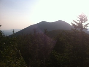
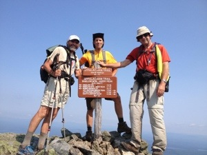
On a beautiful, sunny warm summer day, Molar Man, Susquehanna Slim, and I successfully conquered the Bigelows, the last major range on the AT in Maine. We knocked off a fairly challenging 16.1 mile day in less than ten hours. And more importantly I passed the 2000 mile mark in the early morning. I haven’t used the word “awesome” to describe any hikes lately; however, today’s hike was awesome. From the picturesque views of ponds from the peaks of 4000 foot mountains to gently rolling pine straw laden segments, all was good today on the Appalachian Trail.
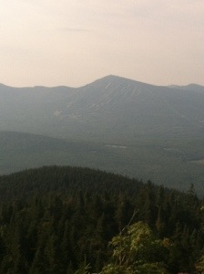
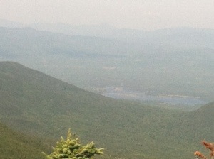
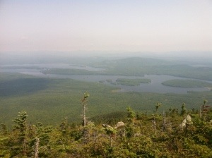
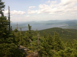
The most difficult part of today’s hike occurred at the outset. MM, Slim, and I faced a significant climb of 2600 feet over a little over four miles. Several extremely steep sections made each of us stop occasionally to regain our momentum. Fortunately there weren’t any technical issues with which to deal. It was just a long hard climb. Views of lakes and ponds were visible from several vantage points. Under perfect weather conditions, Cranberry Pond and Horns Pond appeared crystal clear from the higher elevation.
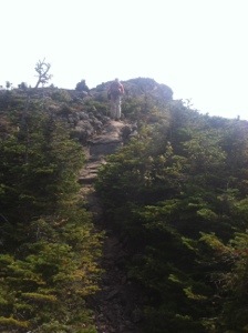
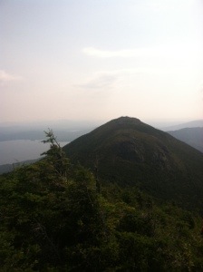
After reaching South Horn at 3831 feet, we continued working our way up the Bigelows. Bigelow Mountain west peak challenged us with an exposed summit and high winds. Even though the trail traversed close to a precipitous drop off, I never felt like there was any danger. For the most part I was able to walk up the rock ledges without having to use my hands. We took a brief break at the top, but needed to move on quickly due to the wind.
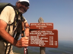
From the 4145 west peak the trail dipped slightly before ascending again to Avery Peak at 4090 feet. At the summit of Avery a sign designating the 2000 mile mark stands. The peak is actually about six miles past that milestone according to this year’s standards. Even though the trail changes periodically, signs remain in their original places. Some old ones provide inaccurate distances. At the peak I talked with two hikers from New Hampshire, Jeff and Ray, who were climbing all the New England 4000 footers.
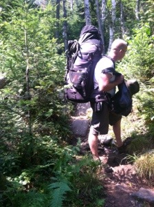
From Avery peak the trail descended to Safford Notch and then leveled before ascending again to Little Bigelow Mountain. The trail then descended 1200 feet before leveling off over the last two miles to Bog Brook Rd. where Sweet Tooth was waiting. On the descent from Little Bigelow we met section hiker Abe and his young son Abel. Although he was out for only five days, Abe was carrying about the biggest pack I have ever seen. He said it contained beach towels and goggles along with dog food and other sundry items. I’m not quite sure why he needs all the items he mentioned carrying.
So as my day winds down I feel a sense of relief over having no more major mountains except Whitecap and Katahdin. Tomorrow’s trail looks agreeable on the map. With sunny skies in the AM predicted, we should be able to get in another longer mileage day, headed north on the Appalachian Trail.