Author Archives: donsbrother4

PA 443 to PA 501

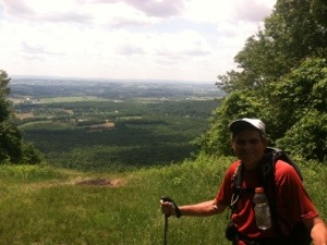
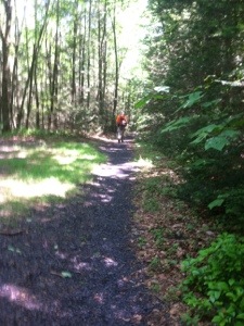
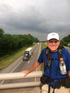
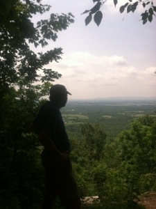
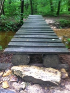
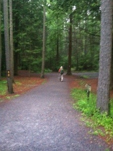
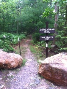
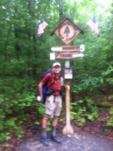
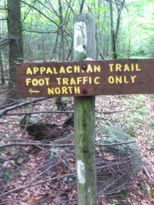
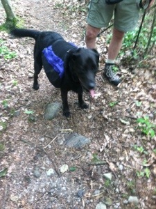
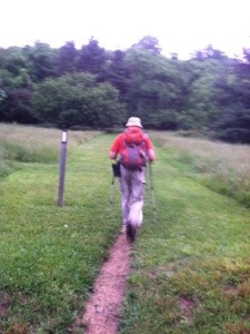
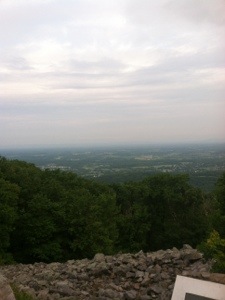
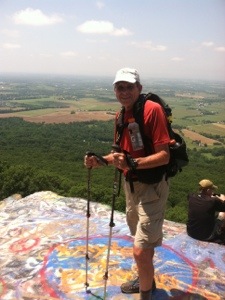
Molar Man asked, “Are we almost to the road?” “I don’t know; we just came up over that rock pile,” replied the young man with his family. “Rock pile” is not exactly what you want to hear with less than a mile of a 12.8 mile morning hike remaining. As we neared our scheduled meeting with Sweet Tooth and Linda, we met a small army of day hikers, many of them children, on their way to I’m not sure what. We hadn’t really had any views to write home about all day. Still, the single file line of packless people continued. Molar Man and I smiled and said hello to the legion before finally reaching the Kimmel Lookout, the first truly awesome view in quite some time.

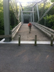
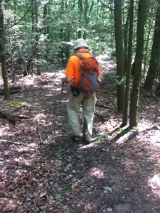
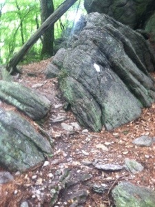
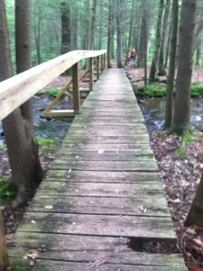
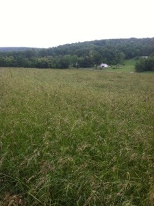
For much of the morning the trail had been a continuous stream of various sizes of rocks. More small ones than large slowed our pace at times. Occasionally, however, we still encountered level, gentle terrain. Early in the hike we missed a turn, which resulted in about a quarter mile walk off course. Fortunately Spirit and Steady were parked down the road. Steady appeared from the RV to greet us as “lost hikers.” Retracing our paths for the distance, we found the blaze that had been partially covered with graffiti. We then proceeded to climb over 700 feet. Other than Finder, we saw no thru hikers. We did meet a couple from outside Philadelphia, Cathy and Ken, who asked about our hikes.

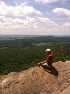
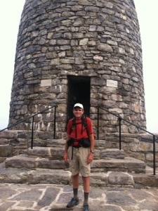
After reaching the parking area on PA 501, unfortunately Molar Man and I had to bid each other farewell again. While he wanted to continue for a 22.1 mile day, I was content with 12.8 and a final afternoon with my wife before she flies back to GA tomorrow. Before we drove away, I walked the approximately 100 yards back down the trail with Linda, Sweet Tooth, and Spirit so that they could enjoy the Kimmel Lookout view. Linda then said her goodbyes to the other two ladies at the car before we headed into Pine Grove.

When we reached the outskirts of town near I-81, we stopped for lunch. As we ate I noticed Fatty across the road trying to hitch a ride. I hollered to her that I would take her back to the trail as soon as I finished my sandwich. She came in and joined Linda and me. I mistakenly labeled Fatty a section hiker in yesterday’s entry. The trim, vivacious young lady from Nova Scotia started at Springer four days after I began, yet we saw each other for the first time two days ago. Now living in Alberta, Fatty plans to visit her Nova Scotia home after finishing her hike in Maine.

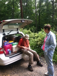
So Linda and I drove our new friend back to the trail before finding a room for the night. We then scouted out the best route to the airport and just did some driving, enjoying the countryside. Tomorrow will be a little sad. For the first time in almost two weeks I’ll again be hiking alone. I’m losing a wife, a friend, and a car, but the woods await. We never know what tomorrow may bring. For me it will most assuredly be more rocks, but it may also be an introduction to a new hiker who might also become a friend. Whatever the new day may offer, the journey will continue up the Appalachian Trail.

20130615-193927.jpg

20130615-193936.jpg

20130615-193945.jpg

20130615-193955.jpg

20130615-194009.jpg

20130615-194020.jpg

Categories: AT Hike | Leave a comment

PA 225 to PA 443

With a 25.6 mile day on the agenda, Molar Man and I headed up the trail from PA 225 at 5:50. I’m actually beginning to like these early starts. In less than three miles we passed Peters Mountain Shelter. Several tents still stood. It was also apparent that few had roused themselves from their shelter slumber at the early hour. So we hiked on throughout a partly cloudy, pleasant morning until we reached PA 325 where Sweet Tooth and Linda had parked. Even though it was still early, this would be our only rendezvous today.

When we walked up I immediately recognized Pilgrim, who I hadn’t seen since Bears Den. He needed a ride to pick up a package in town, so Sweet Tooth agreed to help the Californian out. Also in the parking lot was Bernie the Whittler. He presented me with a hand carved whistle. Bernie said that he was supporting his wife and her sister on about a 400 mile section hike. Under His Wing and In his Feathers were relaxing in the back of Bernie’s van. Before Molar Man and I continued our hike, thru hiker Finder and section hiker Fatty joined the group. I’m not sure why the trim, blond is using the trail name Fatty. Maybe I’ll find out in days to come.

With 16 miles still to go, Molar Man and I hiked at a steady pace for the duration of the day, finishing just after 4:00. Throughout the afternoon we passed and were passed by a few. Blazer and Lentil hiked by on an uphill grade and quickly disappeared. Pfeiffer, who I had not seen since Daleville, and Calamity Jane also passed us. With gentle terrain except for a few stretches of rocks, it proved to be a good day for big miles. It was a personal best for Molar Man and came within .1 of equalling my longest mileage day.

At one point near the end of today’s hike, we stopped to briefly chat with the four ladies who said they were having some girl time. Pfeiffer, Fatty, Finder, and Calamity Jane appeared to be enjoying their break. We also took a brief respite by a stream where Blazer and Lentil were resting. Molar Man and I then hiked steadily the final four miles to reach PA 72 earlier than we had expected. Right before reaching the road we caught Steady, who planned to hike the additional 1.4 to Swatara Gap.

All in all, today’s hike lacked anything really interesting. The trail intersected with a few other trails, and signs indicated where significant structures had stood in the past. I’m glad I got in the miles, but now I’m even happier that I’m about to take my lovely wife Linda out to dinner to celebrate her birthday. What better way to end another day of the adventure that continues on the Appalachian Trail.

20130614-181233.jpg

20130614-181244.jpg

20130614-181254.jpg

20130614-181305.jpg

20130614-181318.jpg

20130614-181327.jpg

20130614-181336.jpg

20130614-181346.jpg

Categories: AT Hike | 1 Comment

PA 850 to PA 225

Molar Man suggested that I begin today’s entry with, “We hiked through a thunderstorm and nobody got killed.” I prefer, My phone rang at 5:45; Molar Man asked, “You ready to hike?” With severe weather in the forecast, I had set my alarm for 6:00, expecting to sleep late for a change. My friend, however, had a different idea. “The bad weather isn’t coming until 4:00,” he informed me. Famous last words is all I have to say. Because when we reached the trailhead a little before 7:00, the skies were rumbling. We looked at each other, told our wives goodbye, and proceeded to hike into a thunderstorm.

Actually, the thunder, lightning, and rain didn’t begin until we had hiked almost a mile. When it did start, it poured, but only for about an hour. Thunder boomed occasionally, but the lightning really never seemed close. As the rain subsided, we both agreed that we were glad to be hiking the trail today even if it was a shallow stream for a few miles. After all, after the feet are drenched, it really doesn’t matter whether or not you walk through the puddles. Molar Man would later change socks at the break. I just hiked in wet ones all day.

When the rain did cease, the humidity kept us sweating. Still we made good time, reaching Duncannon before 11:00. A warning that the trail was very rocky the last six miles into town didn’t seem exactly accurate. Sure there were rocks aplenty but not nearly as severe as what we would face on the last leg of today’s hike. When the trail reached Duncannon, famous among AT hikers for the Doyle Hotel, we were greeted with a road walk (or I should say town walk) for over two miles. A short block before the Doyle the trail goes west to High Street, following the street that runs parallel to Market Street until the edge of town.

Before walking up to High we took a couple of pics of the majestic old hotel. We then meandered through a peaceful neighborhood until the trail turned east to head over the Clark’s Ferry Bridge and the Susquehanna River. After crossing over the river we met Sweet Tooth and Linda at a parking lot under the bridge. Also parked there was Spirit, Steady’s wife. She had been acquainting herself with our ladies in her RV. I also went inside to relax and eat a sandwich that Linda had brought me. With a longer lunch break allotted by Molar Man, it felt good to rest my feet.

When we did start hiking again, we were faced with a climb of about 1000 feet which culminated with a spectacular view of the town of Duncannon and the Susquehanna. It was after the ascent, however, that the hike got dicey. A very rocky stretch of trail, often requiring us to use our hands, slowed our progress over the last few miles. At one point I had to sit on a rock and carefully lower myself down about an eight foot drop. The change of terrain was fun initially, but then it got tedious. When we finally appeared past the last of the big slabs, we quickly picked up the pace to PA 225 where the ladies were waiting.

Just before arriving at our destination, Molar Man and I were passed by Blazer, a thru hiker that neither of us had previously met. I’m 1149 miles into my hike and meet another hiker who started six days before me for the first time. Seems odd, but it continues to happen. Blazer hiked with us to the road where he was offered some trail magic by Sweet Tooth. Also visiting at the Volvo was Steady. I had hiked almost a full day with him out of Waynesboro, VA over two weeks ago and had not seen him since then. Before we left the area, Tugboat, Life Raft, and Finder also showed up to partake of some snacks.

When we did finally head for town, I followed Molar Man in our rental car. Within a couple of minutes I felt more like I was following George Costanza on his way to the Bubble Boy’s house. I barely had a glimpse of the blur of a Volvo as MM exited onto US 233. Telling Linda to hang on, I somehow maintained contact until we thankfully reached a traffic light. From there we made our way to a motel. In the parking lot stood OB, another thru hiker from GA that I had not met, but who had heard of me. His wife Mona had driven up to visit and slack pack her hubby for a few days.

After a hot shower, Linda and I drove back to Duncannon because I wanted her to see the Doyle. While inside we met Paco, a section hiker who has been reading my journal. Having just finished his trek from Harper’s Ferry, he was relaxing at the old hotel. We took some pics, and then Linda and I drove back to our room. All in all it’s been a good day. Tomorrow Molar Man wants to do another 25 plus so I best get some rest. We aren’t sure just what the trail will have to offer, but with clear skies predicted, it ought to be a great day to continue north on the Appalachian Trail.

20130613-202411.jpg

20130613-202425.jpg

20130613-202437.jpg

20130613-202450.jpg

20130613-202505.jpg

20130613-202520.jpg

20130613-202532.jpg

20130613-202547.jpg

Categories: AT Hike | 1 Comment

Boiling Springs to PA 850

Apparently the section of the Appalachian Trail I hiked this morning is maintained by Old McDonald. From a moo moo here to a corn field there, farm land existed as far as the eye could see. Over fence stiles and through several cow pastures, Molar Man and I hiked the first 10.2 miles to the Scott Farm Trail Work Center where Sweet Tooth and Linda met us for a short break. Then we covered the remainder of the 16.5 miles at a steady pace, finishing today’s hike in six and a half hours. With a few dark clouds overhead on a warm day, it was good to get it done early.

In addition to all the farm land, we also walked across three overpasses. The trail crosses I-76, very busy US 11, and I-81. We also encountered more footbridges in the woods. Some appeared to be new, especially in marshy areas. A portion of the trail ran adjacent to a muddy Conodoguinet Creek. Other than a short climb of about 500 feet just before the Darlington Shelter, the trail remained reasonably flat, muddy, and nondescript for the final six miles up to PA 850 where Sweet Tooth and Linda waited.

When we reached the small parking area, the ladies were talking with Mossy Brown, a 2009 thru hiker. She had heard about my hike from Walker when he, Whiskers, and Rocket had passed through the area about ten days ago. Walker had referred to me after Mossy Brown mentioned having a friend recently diagnosed with ALS. Not having seen any of these hikers since Damascus, it was good to know about where they are now. We chatted with MB for a while before heading back toward Carlisle.

My brother Don stayed on my mind much of the day. From an early deer sighting just off the trail to sections of smashed mulberries, memories abounded. I thought of the mulberry trees he and I had climbed as kids on our grandfather’s farm. Then there was another small pond and of course the creek. But the strongest memory was connected to a dog. In his teens, my brother got an Irish Setter at Christmas one year. Don loved Red and hated to have to have him put down when the old dog got too sick to barely stand. As I walked through the filtering sunlight early in today’s hike, two dogs came charging down the trail. The second, an Irish Setter, looked old and tired. His owner said he was nearly deaf. When I asked his name, she said, “Red.”

Even hiking with a buddy like Molar Man, there are stretches when neither of us has anything to say. I suspect that he, like I, is often lost in memories. Today is Wednesday. On Wednesdays last year Linda and I regularly shared a meal with Don and Lisa. It became our routine to meet at our condo. Don enjoyed wheeling his power chair out over the river before we would go inside. When he could still speak coherently, he quietly stated one night, “I like this place.” He was at peace by the river. I miss those Wednesdays.

So another day has passed on the Appalachian Trail. For me it was day 82. Tomorrow severe weather is predicted, so Molar Man and I are going to wait for morning to plan our day. I’m not sure either of us is interested in any tornado blazing. Still, if it’s just rain, we’ll probably be back on the trail. Today proved to be another day that my brother would have liked. So I will walk on as I keep remembering how much…..Don loved the woods.

20130612-195617.jpg

20130612-195629.jpg

20130612-195649.jpg

20130612-195706.jpg

20130612-195719.jpg

20130612-195736.jpg

20130612-195746.jpg

20130612-195759.jpg

20130612-195808.jpg

20130612-195828.jpg

Categories: AT Hike | Leave a comment

Boiling Springs

Some say the most important word for thru hiking the Appalachian Trail is flexibility. Due to a cancelled flight by Delta Airlines, today’s plans indeed required me to be flexible. After we found out that Linda’s flight had been re-scheduled to arrive late in the day, I decided to go ahead and hike the 19.6 miles into Boiling Springs with Molar Man. Since my plans didn’t change until late last night, I wound up only getting about five hours of sleep. Still, I hiked strong throughout the day, partly due to following behind the “machine.” Molar man’s ability to set and hold a pace of about 2.75 miles per hour is uncanny. I don’t even check the itinerary as we hike. He keeps me well-informed.

When the alarm sounded at 4:15 I had already been up a quarter of an hour. Thinking I might find an all night restaurant, I headed for our meeting in my rental car at 4:30. A convenience store with hot breakfast sandwiches and coffee met my needs. As daylight approached, I sat in the car having my meal. Then I drove to the rendezvous with Molar Man and Sweet Tooth for the ride back to Pine Grove Furnace State Park and the beginning of today’s hike. No one else was around as we made our way through the manicured park and finally back into the woods.

All went well early until we reached a spot where a white blaze led us down to a impassable stream with no bridge. Not seeing a blaze on the other side, I suspected that we had made a wrong turn somewhere. With his pioneer instinct, Molar Man bushwhacked to a spot to cross. Before I decided to go ahead and just walk through the ankle deep water, I retraced my steps up the trail to discover that the trail we were on should have been blazed blue. It looked as if a previous blue blaze had been painted over with white. When we finally got back to the real white blazes, Molar Man turned up the pace to make up for the ten minutes lost in futility.

After approximately a twelve minute lunch break (long, by Molar Man’s standards), we continued to make good time until we hit the first of two rock mazes. The boulders of various sizes, from large appliances to small homes, required a degree of patience. With blazes aplenty and an arrow here and there, I thought the navigation of the mazes would be fairly easy. There’s that word that has no place on the AT again. Then I looked ahead to see Molar Man standing atop a two-story rock looking for an outlet. His choice of directions worked for him. I went another way which required a little rock scrambling. All in all, the variety was refreshing.

Like the other days in Pennsylvania, a number of footbridges were provided for most water crossings. Late in the hike we passed Center Point Knob where a statue had been erected to indicate the original AT midpoint. A short while past this landmark we found ourselves hiking a path that passed through a cornfield. My dentist/engineer/farmer friend educated me on some aspects of corn growing. He also answered, “alfalfa,” when I asked, “What’s that?” After we walked through the farmland for over a mile and a half, we finally reached the small one way bridge leading into the quaint little town of Boiling Springs, home of the ATC Mid-Atlantic Regional Office.

As the trail enters the town, it passes by a lake. A few fishermen sat in chairs at the bank on the warm, lazy afternoon. One young lad cast his rod as his dad watched. When he said he wasn’t catching anything, I noted, “But you’re having fun.” The dad replied, ” That’s what it’s all about.” On another afternoon twenty or so years ago, that could have been Don and Brent. My brother loved to fish with his son. And Don would have definitely loved Boiling Springs, a town that seems Mayberry-like in a peaceful way. I could see him relaxing by the lake, just enjoying.

It’s been another good day to hike. I shared a special section of trail with someone who has become a good friend. Our hiking styles, as well as our demeanors, seem to complement each other well. Tomorrow we’ll hike together again. For now, however, I’m off to the Harrisburg International Airport to hopefully meet Linda’s plane. If all goes according to plan, when morning arrives, she too will begin to learn just how special life can be on the Appalachian Trail.

20130611-180321.jpg

20130611-180335.jpg

20130611-180352.jpg

20130611-180404.jpg

20130611-180413.jpg

20130611-180422.jpg

20130611-180430.jpg

20130611-180439.jpg

20130611-180448.jpg

20130611-180544.jpg

20130611-180605.jpg

Categories: AT Hike | Leave a comment

Pine Grove Furnace State Park

Most years some re-routes of the Appalachian Trail occur, which usually means a slight variation in distance. This year’s trail measures 2185.9 miles, a 1.9 increase over the trail of 2012. The half way marker, however, dates back a few years, indicating that the half way mark is 1090 miles. Nevertheless, as of today I have hiked 1095.6 miles by last year’s standards. I have now officially completed over half of the AT. So from now until completion, I will have fewer miles to walk than I have already walked. To be quite honest, that makes me feel pretty good. As a matter of fact, it makes me feel real good.

When Molar Man and I hit the trail this morning at 6:10, there was rain in the forecast. Within about an hour it started. Throughout the day we hiked in a steady rain although it never rained very hard. It was late morning before my clothes and shoes were thoroughly soaked. Then I just slogged along, not worried about stepping in numerous puddles on the trail. There were also several water crossings, but for the most part, footbridges were provided. At one place I was trying to select the best rock skipping strategy when I noticed out of the corner of my eye that Molar Man was traversing the stream via footbridge. I hadn’t even seen it.

Aside from the rain, today’s trail offered very little to get excited about. We passed through Caledonia State Park early in the day and then by another “double shelter” at the Quarry Gap Shelters. Like all the shelters I’ve passed so far in Pennsylvania, the amenities looked inviting. Hanging baskets even adorned an arbor of sorts. I suppose I should eventually take advantage of one of these impressive structures. Perhaps there is a Pennsylvania shelter in my future. A few hikers were still in their sleeping bags as Molar Man and I passed by Quarry Gap.

If I were rating today’s hike on the 1-10 scale for difficulty, with 10 being extremely difficult, I would call today’s trail a 1 or 2 all day. With the easier terrain, we hiked the 19.5 miles in less than seven hours, despite the rain and mud. One noteworthy aspect was the numerous road crossings. We crossed 12 to be exact. In two cases, five gravel roads intersected where the AT moved from one side of the woods to the other. Most of the roads were hard packed dirt or gravel, but a few were paved.

When we reached mile 1090, a sign indicated that the half way point had been reached. Molar Man and I took a brief break here for pictures. Then we passed the Toms Run Shelter before finally arriving at the road leading into Pine Grove Furnace State Park. We walked by a hostel before reaching our final destination, the General Store. Sitting out front were several thru hikers including Finder, Calamity Jane, Sundance, Hooker, and Triple 6. The last time I had seen Finder was at Woods Hole.

Triple Six, another of the Germans on the trail, was trying to finish off his half gallon (it’s now really a quart and a pint) of chocolate mint ice cream for the half gallon challenge. It is an AT tradition for thru hikers to attempt to eat a half gallon of ice cream at the half way point of the trail. I opted for the half pint challenge instead. I’m not sure I could have consumed the larger portion, but the chocolate marshmallow smaller size sure tasted good after my hike in the rain. Molar Man selected a drumstick for his challenge.

After leaving the park, we headed to Boiling Springs and a stop at the ATC Mid-Atlantic Regional Office. Just as we arrived Ambassador and Sugar Bomb also walked up. It had also been some time since I had seen the affable Sugar Bomb. We chatted on the porch, and then I went inside to purchase AT maps for the next five days when Linda will be shuttling me. From there Molar Man and Sweet Tooth were very thoughtful to drive me to Carlisle, about five miles away, where I could pick up a rental car that I had reserved.

After saying our goodbyes until somewhere up the trail, we parted. Inside the Enterprise office I was helped by Courtney. I must say that I received excellent customer service. From there I checked into a motel, showered, and went for a late lunch. It felt luxurious to be able to drive to a meal. Tomorrow I’ll take another day off. Then the landscape will change as my wife becomes my helper for a few days. Stay tuned for Linda’s indoctrination to the life of the thru hiker on the Appalachian Trail.

20130610-183133.jpg

20130610-183143.jpg

20130610-183153.jpg

20130610-183201.jpg

20130610-183209.jpg

20130610-183218.jpg

20130610-183230.jpg

20130610-183240.jpg

20130610-183252.jpg

Categories: AT Hike | 3 Comments

Pen Mar Rd. to US 30

The story almost read, “AT THRU HIkER ‘KNOCKED’ FROM TRAIL.” Don’s Brother, an Appalachian Trail thru hiker from Georgia, came close to having his hike suspended today when he ran into a large, overhanging tree limb. Briefly staggering backward, DB commented that he felt his teeth rattle before he regained his composure. Hiking companion, retired dentist Molar Man of Ohio, made no effort to check Don’s Brother’s dental work; however, he did pause long enough to ascertain that there was little chance that a concussion had occurred. For the remainder of the 17.8 mile day, Don’s Brother paid closer attention to his surroundings.

Hitting my head on the tree really wasn’t that big of a deal. There just isn’t that much to write about today. With another early 6:10 start, Molar Man and I managed to complete the hike in just under seven hours. The first full day in Pennsylvania could be described as boring. We climbed a little, descended a little, walked level occasionally, and confronted a couple of sections of “from washing machine to refrigerator size” rocks. Pennsylvania is often referred to as Rocksylvania, so I suppose what we encountered today is a precursor to what lies ahead.

We also crossed a few streams with footbridges. “Footbridge” has become one of my favorite AT words. Every time I hear the sound of distant water, I start wondering whether or not there is a bridge for crossing. Today there were four. There were also some patches of black mud on the trail today. They could be circumvented most of the time, however. And as always it seems, there were several short sections with smaller oddly shaped rocks. The trail offered up some variety. It just wasn’t very interesting.

We passed two locations where two shelters stood side by side. At the Tumbling Run Shelters, pea gravel had been spread to enhance the site’s ambiance. “Two” appeared to be the operative number because there were two picnic tables as well. Molar Man and I took a break there. Fis, the section hiker we met yesterday from Massachusetts, had also stopped for a snack. Other than some day hikers, we didn’t see many folks on the trail today. For the second consecutive day, we saw no other thru hikers. We did, however, meet the Gettig family from Fayetteville, PA out walking three of their dogs. I had never seen Italian Greyhounds before today.

When we reached US 30 and the end of today’s hike, Sweet Tooth was waiting. We drove back to Pine Grove Furnace State Park where I consumed a pint of Butter Pecan ice cream. Then Molar Man drove to scout locations for day after tomorrow. He was also nice enough to drive into Carlisle, where I plan to pick up a rental car after tomorrow’s hike to use while Linda visits. After that we headed to a motel and called it a day.

Indeed it has been a beautiful Sunday. Don might have been sitting on his deck, waiting for a deer to walk up in his back yard on other Sunday afternoons like today. I think he would be happy to know that tomorrow I will reach the true mileage half way point as I return to continue the journey on the Appalachian Trail.

20130609-173806.jpg

20130609-173819.jpg

20130609-173830.jpg

20130609-173843.jpg

20130609-173852.jpg

20130609-173900.jpg

Categories: AT Hike | 1 Comment

Turners Gap to Pen Mar Rd.

Goodbye Maryland. Hello Pennsylvania! Today I walked into the 7th state on the Appalachian Trail, passing the Mason-Dixon Line just prior to Pen-Mar Rd. I guess I’m officially in the north. The blue skies and white puffy clouds enhanced the enjoyment of the final few miles on a comfortable 23.5 mile day. Despite a few tough stretches of rocks, some slanted in various directions, today’s hike progressed about as smoothly as any I’ve done over the entire trip. I continue to be at my best using my motto of “light pack, big miles, and beds.” Hey, it’s working.

So when Molar Man said he wanted to get an early start, I had no idea he meant that we would be standing in the lobby of McDonalds at 5:00. With breakfast to go, we drove along with Sweet Tooth to the trailhead at Turners Gap, arriving in time to begin the hike at 5:45. Chirping birds and a couple of scurrying squirrels greeted us as we ascended the first gradual incline shortly after dawn. Just prior to the two mile mark we walked into Washington Monument State Park. A side trail of about fifty yards led to the “original” Washington Monument, a stone edifice erected in 1827. After a brief stop and photo opt, Molar Man and I picked up the pace.

With a slightly humid, overcast mild morning, we banged out the miles at near record pace. By 8:00 we were crossing the footbridge over I-70. Sparse traffic travelled the interstate on this early Saturday morning. We zipped by the blue-blazed trail to Annapolis Rocks, choosing to make miles rather than check out yet another view. By 11:30 we had already hiked 14.9 miles to Foxville Rd. where Sweet Tooth waited with the cooler and snacks. I had packed two burgers and a root beer, but I did take a bag of chips. While we ate, section hiker Fis walked up and graciously accepted some of Sweet Tooth’s trail magic. Molar Man and I would pass her shortly after resuming our hike. We would see no thru hikers, however, all day.

As the afternoon began, we encountered a challenging segment of rocks which required some diligent maneuvering. Molar Man continued to lead and I followed throughout most of the day. When we got to the north end of the High Rock Loop Trail, I convinced my buddy that it was worth the short walk to the scenic view. With a tad of reluctance he agreed. Several folks were hanging out at the site that had formerly been used for hang gliding. A young man from Rockville, MD, Carlo, told us that rock climbing permits can be obtained for the dangerously steep looking outcrop. A section hiker at times himself, Carlo offered to take our picture.

When we returned to the trail, we were again faced with an extremely rocky descent. I painstakingly navigated the rocks, falling behind Molar Man. After the rock section we arrived at Pen-Mar Park, one of the prettiest recreation areas I’ve seen thus far. I commented that this would be an ideal place for some “yogi-ing” on the busy Saturday afternoon, were we not so close to the end of today’s hike. Since Pen-Mar Rd. was less than a mile away, however, we just kept moving, arriving at the road a little after 3:00. Indeed, we had knocked out big miles in good time.

Today was a great day to hike. For Don, it would have been a great day to fish. He often had already launched his bass boat, readying for a day on the lake, at about the same time I started hiking today. On many picture-perfect Saturdays like today, he would in all likelihood have still been casting away. There were no lakes on today’s hike, but there were many reminders of my brother’s life. Ferns bordered the trail in several areas today. As I passed through them on either side, I was reminded of how Don regularly brought ferns to our mother and how much she appreciated his kindness. Today beauty abounded everywhere as it does so often on the Appalachian Trail.

20130608-175821.jpg

20130608-175907.jpg

20130608-175917.jpg

20130608-175928.jpg

20130608-175946.jpg

20130608-180003.jpg

20130608-180015.jpg

20130608-180031.jpg

20130608-180040.jpg

20130608-180050.jpg

20130608-180105.jpg

20130608-180115.jpg

20130608-180123.jpg

20130608-180135.jpg

20130608-180145.jpg

20130608-180207.jpg

Categories: AT Hike | Leave a comment

AT Museum

Whether one sleeps in the woods or in beds, it takes a lot of planning to thru hike the Appalachian Trail. Today was one of those “getting ready for the next four days” days. Since it was also my second respite in the last seventy-two hours, I wrestled over the necessity of such a day when I awoke to gray skies, but no rain. Thinking I would rather be hiking, I had to convince myself over breakfast that all was for the best. When the steady, bordering on cold, rain began, I realized that my decision was a good one.

So for much of the day I rode in the back seat of the white Volvo, mentally taking notes on just how a supported hike can be fine tuned. Molar Man and Sweet Tooth have a method that works for them. We first drove back to where we left the trail yesterday so that Molar Man could navigate, via very precise AT maps, where Sweet Tooth could meet him with lunch and also where she could pick us up at the end of tomorrow’s hike. Given all the “back roads” and state highways that sometimes don’t even appear on a traditional roadmap, the “preparation and rehearsal” phase is indeed necessary.

After arriving at Pen Mar Rd., where we will finish hiking tomorrow, we drove into Waynesboro, PA and then to Caledonia State Park where Sunday’s hike will conclude. Checking places to meet along the route, we finally made our way up to Pine Grove Furnace State Park, the half way point and home of the Appalachian Trail Museum. Visiting the historic building, which truly captures the essence of the trail, was the highlight of the day. It was especially meaningful since I had read about many of the exhibits on display. Taking a break at the Pine Grove General Store was thru hiker Colin that I had last seen at the Audie Murphy Memorial.

From the park we scouted out places for Molar Man and Sweet Tooth to meet the following day; however, I only plan to hike with them the next three days. In fact, one of my reasons for rejoining them for a bit revolves around next week. Linda will arrive on Tuesday, so I hope we can duplicate the Ohio couple’s scheme for a few days. My mental notes better be good. I wouldn’t want my lovely wife lost some place like Rattlesnake Run Rd. Yes, there’s one in Pennsylvania. But hopefully after learning Molar Man and Sweet Tooth’s strategies, Linda and I will be just fine.

It has been a good day. Despite taking a day off, much got accomplished. Clouds are still lingering overhead, but tomorrow’s forecast calls for sunny skies, at least in the afternoon. A few Junes ago, Don would have been getting his gear ready for some bass fishing tournament on a Saturday morning. He competed in many and won a few. For me Saturday will provide another opportunity to move on up the trail. I couldn’t be more excited to get to the state famous for its rocks. Great days lie ahead as the adventure continues on the one of a kind Appalachian Trail.

20130607-170251.jpg

20130607-170307.jpg

20130607-170324.jpg

Categories: AT Hike | Leave a comment

Harper’s Ferry to Turners Gap

June 6, forty-seven years ago was the last day of school my freshman year. My German teacher, Mr. Russell, wrote the date on the green chalkboard, 6/6/66. He commented that it would be over eleven years before the date could be written using only one numeral. At the time 1977 seemed so remote that it could have been a hundred years in the future. Little did I know as a lad of 15 that before 7/7/77 rolled around, I would be married, have two college degrees, and be a high school teacher myself. Every year on June 6, I still remember Herr Russell.

Over the years I section hiked the AT, I would usually begin as soon as the school year ended, so I’ve often been on the trail on June 6. Today I walked out of the state with the fewest number of trail miles and into the state with the second fewest. Walking across the bridge over the Potomac took me from West Virginia into Maryland, the 6th state heading north. I felt inspired and motivated on the overcast early morning. I had arrived in my sixth state on the sixth day of the sixth month.

Since I wanted to get started before 7:00, I called John for a taxi to the trailhead at the east end of High St. in Harper’s Ferry. He dropped me there at 6:40. After crossing into Maryland, the trail follows the old C&O Canal Towpath for three miles. Along that stretch I saw two runners, a cyclist, and a lady walking six dogs, all hers she said. A deer came into view at a distance but had disappeared by the time I reached the spot. The flat spacious terrain made for fast hiking. Even though I had to wait for a train to cross at the north end of the towpath where the trail begins to ascend toward Weaverton Cliffs, I averaged right at 3 miles an hour for the first six miles.

When I reached the short trail to the Ed Garvey Shelter, I took it. Ridge runner Claire was leaving as I arrived. After a short break I resumed my hike, stopping briefly to speak with Bearhawk, a southbound section hiker. I met others, but only said hello before moving on. With a relatively “easy” trail (Maryland only rates a 2 on the 1 to 10 scale), I continued to hike at a fast rate.

When I reached Gathland State Park, I took a break and briefly entered a museum. Sweet Tooth had parked nearby to wait for Molar Man to hike by. Rock Steady arrived as we talked. Before exiting the park I met trail angel Peggy from Pensacola. She was waiting for a group of hikers that she was supporting on a series of day hikes of the AT. Hancock and Gypsy were also hanging out at the picnic tables under a pavilion. Just as I left the park the rain began.

In order to reach my end point for the day before the heavy rain that was forecast began, I continued to hike quickly. I did stop at White Rock Cliff for the view. Then I zigzagged my way through a series of small rocks for a couple of miles to the Dahlgren Campground. By then the rain had increased. Rock Steady, Hancock, Gypsy, and two section hikers from Norfolk were also under the overhang, trying to keep dry. It was then that I changed my plan for the day. Since there are serious storms in the forecast for tomorrow, I decided to stop at Turner’s Gap for a 17.5 mile day. This way I could get a lift from Molar Man and Sweet Tooth rather than risk being at a hostel or shelter all day tomorrow.

When I finally got back to the trail to hike the final .3 mile, the rain had gotten heavier and colder. Rock Steady and I hiked together. He headed on up the trail as I took refuge under the front eave of a church to wait for the Volvo. Feeling a little chilled, I removed my wet T-shirt for a dry long sleeve one. I also put on my raincoat and gloves, knowing that the wait would be over an hour. As soon as Sweet Tooth parked I made a dash for the car. Molar Man soon arrived and we were off to Hagerstown.

So after another comfortable day of hiking, I’m again in a very nice motel room. I hate to take another day off so soon; however, it’s unlikely that many will hike tomorrow if the weather that is predicted arrives. Still, I had recently earned two more zero days based on my 15 miles a day formula. So I’m really in the same place that I was three days ago, regarding how many days I can still take off and reach my goal of a late August summit. So after a lackluster finish to Virginia, I re-energized in WV and started Maryland in a positive manner. Now I’ll prepare to make my way over the Mason Dixon line when I again hit the Appalachian Trail.

20130606-203524.jpg

20130606-203535.jpg

20130606-203544.jpg

20130606-203555.jpg

20130606-203607.jpg

20130606-203616.jpg

20130606-203626.jpg

20130608-180245.jpg

Categories: AT Hike | 2 Comments

Blog at WordPress.com.