Author Archives: donsbrother4

Damascus to US 58

Today’s hike was as much about people as it was about the trail. It began with seeing Walker, whom I had not seen in three hundred miles, to being rescued by Snowball’s family, Anne and Eddie Blevins. In between the cast just kept increasing. Every day events occur that I never expect when the day begins. Today was no exception.

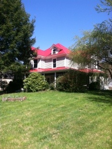
I walked out of the front door of the Montgomery Homestead Inn at 7:00 directly onto the trail which runs down Laurel St. When I got to Cowboy’s I stopped for a hearty breakfast. Inside I met for the first time Trucker and Z-Man. While we talking over breakfast, in strode Walker, a hiker from Atlanta that I had first met at the Aquone Hostel. A member of his family had commented at my website, so I was happy again to see the fellow Georgian. Trucker seemed interested in my journal, so the three of us talked about Don.

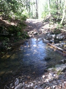
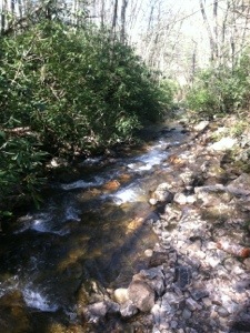
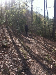
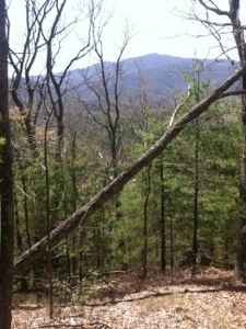
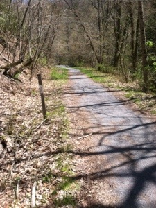
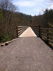
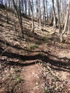
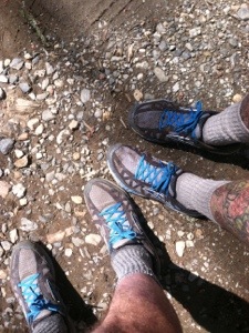
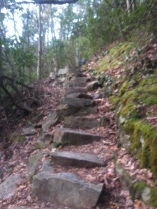
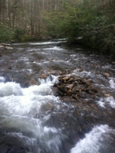
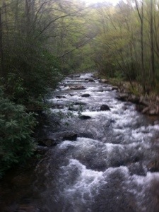
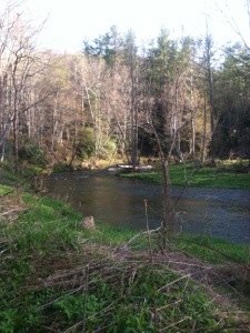
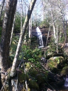
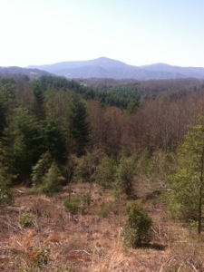
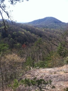
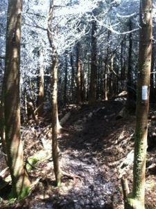
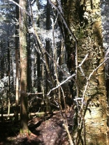
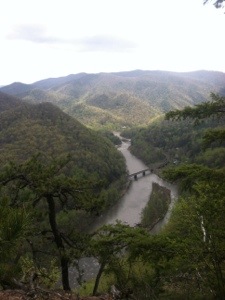
Lingering too long over my eggs and pancakes, it was a little after 8:00 before I continued the hike out of Damascus. Just as I returned to the trail Whiskers and Rocket were also starting, so I hiked along with them for part of the morning. After an early climb, the trail today resembled many other days of a walk through the woods. There were numerous water crossings; however, none proved difficult. Some required rock skipping while others had foot bridges. The sounds of the rushing waters were a constant companion for over an hour.

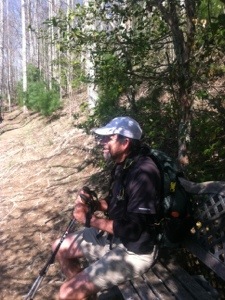
Twice today I met southbound section hikers that I told about my hike. Sandalwood and Alloy, from just north of Toronto, Ontario, are spending several days on the trail. Heart Walker and 2 Stent are fellow Georgian sectioners. 2 Stent, from Valdosta, said that his son graduated from Columbus State University. Both has previously been heart patients. I also passed and was passed back by Starman 28, a hiker from Vermont that I had seen a couple of days ago. Trucker and I leapfrogged throughout the day as well.

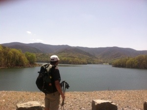
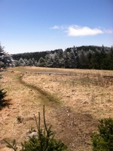
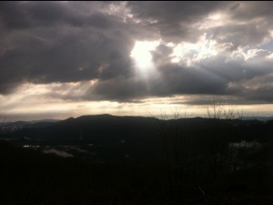
With a mild sunny day and gentle terrain, the miles zipped by. When I reached HWY 58, where I intended to end my hike today, Whiskers and Rocket were waiting by the road. They too had decided to return to Damascus. Having been told by someone in town that this was an easy hitch, I had not arranged for a shuttle. After trying for about half an hour I realized that the info had not been accurate. Finally, I suggested that if I walked farther up the road perhaps the two of them could get a ride.

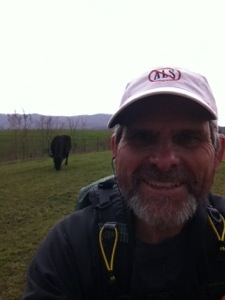
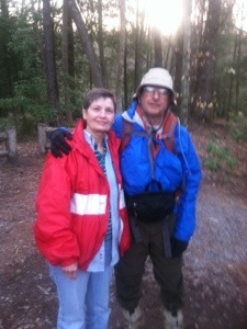
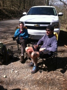
This is where the rescue commenced. When I finally came upon a rural home, two dogs greeted me at the roadside. Seeing their owners in the yard, I asked to use their phone to call a shuttle, since I had no cell service. After that option failed I asked if I could pay the folks to drive me to Damascus. They were kind enough to agree as long as I didn’t mind sharing the backseat with Snowball, a part border collie with about as pleasing a personality as I have ever encountered in a dog. He provided good company as did Anne and Eddie on the ride into town. The conversation moved from their Christmas tree farm to a rental property to Eddie’s fishing. When I showed Eddie the picture of Don and the big bass, he seemed impressed. I think Eddie and my brother would have hit it off immediately, and I know Don would have taken a liking to Snowball. I can’t thank the couple (and Snowball) enough for the ride. They were true trail angels, refusing to take any money for the ride.

After arriving back at the inn I tried to call Whiskers. Since his phone went to voice mail, I assume he and Rocket decided to camp. After my call, another people moment occurred. While I was sitting in the parlor looking over possible itineraries for tomorrow, another hiker arrived. She introduced herself as Journey, thru hiker from 2003 and friend to my friend, Switchback. Also a member of the trail journal community, it was special meeting her.

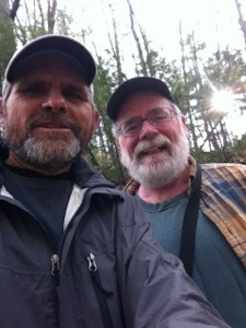
My final people encounter of the day occurred during supper at the Blue Blaze Cafe. While dining, Journey asked if I knew a hiker who was seated behind me. When I turned around, to my surprise it was The Raisin Bran Kid. I hadn’t seem him since the day before Franklin. Kid came over to explain that he was dealing with an injury. A postal worker from Ohio, he expressed frustration over having to curtail his miles. I was sorry to hear of his problems, but it was still great to see the Kid again.

So now I’m planning my tomorrow, a day when rain is in the forecast. Every day is a new day, so once again, there’s no way to know what awaits the northward journey on the Appalachian Trail.

20130426-213540.jpg

20130426-213555.jpg

20130426-213607.jpg

20130426-213617.jpg

20130426-213631.jpg

20130426-213644.jpg

20130426-213656.jpg

20130426-213709.jpg

20130426-213720.jpg

20130426-213731.jpg

Categories: AT Hike | 5 Comments

Low Gap to Damascus, VA

Moving lumber has never been my forte; however, since that’s what Warren requested that I do for my “work for stay,” I resumed the task early this morning. After my work responsibility was complete, I got my full pack ready for today’s journey. I also phoned Susie at the Montgomery Homestead Inn in Damascus to reserve a room for the next two nights. She was most accommodating, allowing me the option of a third night if I so choose. I hope to use Damascus as a base for the next three day’s hikes similar to what I did in Erwin.

Since Warren wasn’t able to drive me back to Low Gap until late morning, it was after noon before I headed up the trail. A climb greeted me from the outset, but I still made good time until I reached the crest. Then for the remainder of the afternoon the trail was relatively flat with occasional minimal ups and downs. Within the first two hours I saw Mr. Gigglefits and Paisley taking a break. Throughout the day we leapfrogged one another. I passed thru hiker Sonny and also passed Outfitter and In Progress, who were slack packing today.

When I arrived at the Tennessee/ Virginia border, In Progress took my picture by the sign. I returned the favor for her and her husband. Reaching my fourth state was special. Virginia comprises about one-fourth of the entire trail; therefore, it will be about a month before I reach the next state. Even though I don’t have a firm schedule, I’ve made it to Virginia about two days before I had expected. With my light pack in tow, I hope to continue averaging over 15 miles per day for as long as I can.

Shortly after crossing into Virginia, Moses passed me for the second time today. I tried to keep up, but he quickly disappeared into the distance even though I was hiking at a good clip. By the time I first saw the town of Damascus from the ridge line, I realized that I was making excellent time on the planned 15.2 mile day. When I reached the outskirts of the city, I called to let the innkeeper know that I was nearby.

Coming into Damascus, the AT passes through a park before heading up the center of town. While in the park I struck up a conversation with a man walking his two dogs. Trace had thru hiked in 2003, met his wife on the trail, and later moved to Damascus. We walked together until I reached the street where my inn was located. When I arrived at the inn, Hester gave me a tour and showed me my room.

After settling in and showering I walked about a block to the Blue Blaze Cafe. As I approached the restaurant, Whiskers and Rocket were walking toward me. I think we all began smiling simultaneously. I had not seen them since Hot Springs. Before going into the cafe I walked down to a bridge at the end of town and met Shutterbug, a young lady from Indiana who had taken some time off the trail due to injury. Later when I finally reached the Blue Blaze, Shutterbug was there and asked me to join her. It was enjoyable chatting with the English major from IU. I told her about Don and my journal before wishing her well on her hike. Since I’m hiking faster than she is I may not see her again. With the AT community, however, you never know.

Today’s hike was special because I reached my fourth state. It was also a day when I reflected often on my brother. I thought about how much I would like to talk about the Braves with him and how I would like to tell him about my hike. But then again, I think he knows. Tomorrow I have options, but one given is that I’ll spend another night in Damascus. The forecast is for sunshine, so if all goes well, I’m looking for another beautiful day to hike north on the Appalachian Trail.

20130425-222044.jpg

20130425-222101.jpg

20130425-222115.jpg

20130425-222136.jpg

20130425-222209.jpg

Categories: AT Hike | 2 Comments

Wilbur Dam Rd. to Low Gap

My day began behind the wheel of Warren Doyle’s back-up automobile, an older model, faded red, Ford Escort station-wagon, with a stick shift. The odometer is frozen at 316,370 miles. So at just after daylight I followed the taillights on Warren’s other compact into Damascus. Our stop was Cowboy’s, a local eating establishment often frequented by hikers. At the early hour no 2013 thru hikers were there. The hiker that was there, however, was Warren Doyle, the man who is to the Appalachian Trail what Jack Nicklaus is to the PGA, a major record holder. For the duration of our meal I had the honor and privilege of conversing with a legend.

Warren has thru hiked the entire AT a record 16 times. He is currently planning his next AT group expedition for 2015. Thirty-eight would be hikers will soon be attending an orientation session at Warren’s Appalachian Folk School. Only between 20 and 25% of those who attempt an Appalachian Trail thru hike are successful. About 75% of those who attend Doyle’s school succeed, which makes his AT Institute very popular among the novice and experienced alike.

Today Warren was headed to Hot Springs to meet friends for a day hike, so his idea was to place the Escort at Low Gap, where I would finish today’s 22.6 mile jaunt. After we made that stop, Warren shuttled me over to Wilbur Dam Rd., where I ended yesterday. Even though he planned to stay in Hot Springs tonight, Warren graciously offered to allow me to drive his car back to the Folk School and to stay the night as well. People don’t get much kinder than Warren.

With another light pack, I started today’s walk at 8:35. Even though the trail climbed over the first four miles, numerous switchbacks made for comfortable hiking. Early today I passed a German couple who seemed to be near my age, Turtle and Snail. A few minutes later I passed another thru hiker that I had not met before, Triple Step. Then when I reached the Vandeventer Shelter I came across Navigator, another hiker from Washington state that is only the second hiker I have met who started after I did. Navigator pointed out a rather large black snake that was resting in the rafters of the shelter. Made me glad I wasn’t staying there tonight.

Throughout the morning I walked a ridge line with views of the Watauga River and rich farm land. Even though the trail was predominately in the woods, views on both aides were interspersed all day. When I stopped for water at a spring a couple of miles before the next shelter, I met two more thru hikers, husband and wife, Outfitter and In Progress. Hiking on I took a brief break at the Nick Grindstaff Monument, the final resting place for someone’s uncle. A small bench had been placed in front of the marker.

By the time I reached Iron Mountain Shelter, I needed a second lunch. Again Navigator was seated in the shelter. While I rested who should appear but Salad Days, the young man who is hiking in the same trail runners I’m wearing, Brooks Cascadias. He stopped to cook up a hot lunch. Before I moved on Risk It also arrived for a break. I bid goodbye for now to all, needing to hike on at a quicker pace.

The trail continued to be gently rolling for several miles. As I approached TN 91, which leads to Shady Valley, TN, I was thinking that trail magic of a cold soft drink would be nice. Only minutes later I came across a cooler filled with cold drinks. I took a Pepsi and silently thanked the members of the church group who had provided not only the beverage but prayers to go along with it. When I reached the road about one hundred yards later, I enjoyed the Pepsi with the last half of a large ham and cheese sandwich on a Kaiser roll.

Just across the road the AT crosses a cow pasture. This won’t be the last. As I climbed a stile and shot some photos, the cows ate the grass indifferently. They did let out a chorus of moos when the rain commenced just about the time I exited their confines. At first it was a cold, blowing rain and then just a steady drizzle, but I still continued to make good time. When I reached the final shelter of the day, I ducked underneath to gulp down a pack of peanuts. Six hikers were already in the shelter for the night. I introduced myself to more folks that I had not seen before. Starman 28 and Titan also has started after me and were flying up the trail.

After the brief respite I hiked on hurriedly due to the cold rain. I covered the final 3.5 miles in what seemed like record speed for me. The trail continued to be forgiving except for some minor patches of mud. Just after six I reached Low Gap, US 421, where the reliable Escort was waiting. After changing into a dry shirt, I navigated my way down the winding highway like a pro. I never once came close to running over the side of a mountain.

I reached the home of Warren Doyle a little over half an hour later. After a shower and starting my laundry, I drove into Iron Mountain for supper and a little shopping for food for tomorrow’s hike. I can’t say enough about how special the past two days have been. The people I have met continue to amaze and inspire me. Thank you, Warren Doyle. It has been truly an honor and a privilege to spend time in your company and your home. Tomorrow the northward walk continues as I hike into Virginia, the fourth state along the Appalachian Trail.

20130424-223457.jpg

20130424-223448.jpg

20130424-223437.jpg

20130424-223508.jpg

20130424-223519.jpg

20130424-223531.jpg

20130424-223553.jpg

20130424-223609.jpg

Categories: AT Hike | 2 Comments

Dennis Cove Rd. to Wilbur Dam Rd.

One month ago today I walked away from Linda, Lisa, and Scotty to begin my thru hike of the Appalachian Trail. Today after a 13.0 mile hike, I have now covered 429.3 miles, or just under 20% of the trail. As I reflect on the first month, I continue to be humbled by the number of people who are reading my journal. I greatly appreciate all the comments, emails, and text messages, and hope that they will continue. I wish I could respond to each; however, little time is available during my very structured day. On most mornings I’m up by 6:00, hiking by at least 8:00, and too tired to do much in the evening other than write, call family, and rest. Still, all is well.

Molar Man and I hit the trail this morning at a little after 7:00. From the outset, many large rocks, including several rock stair steps, forced us to be careful and hike a little more slowly. The cascading waters of Laurel Falls highlighted the early morning. The rocky trail literally almost touched the fast moving stream. The sounds of the falls could be heard far up the trail. Past the falls the trail began to ascend. We hiked steadily up for over two miles with an elevation gain of over 1700 feet.

The ascent was followed by a descent all the way to US 321 where Diane was waiting with Molar Man’s lunch and a cold drink for me. The park adjacent to the Shook Branch Recreation Area still revealed signs of recent flooding. Partially submerged picnic tables dotted the area. Signs had been posted indicating a 0.3 mile detour since water covered portions of the trail around the Lake Watauga. I wondered what fish might be in the beautifully blue lake as I thought about my brother. Don would have liked Lake Watauga.

After making our way around the lake, Molar Man and I hiked on to where a dam crossed the water. The trail followed a paved road for almost half a mile. When we finally returned to the woods, the terrain was relativity flat for the remainder of the hike. Due to the shorter distance, we finished today’s walk at around 2:00. We had seen only three other hikers all day. Two were out for the day, and the other was a southbound section hiker. It has seemed rather odd that we have seen so few hikers the past three days.

When we arrived at the Wilbur Dam Rd., Diane was waiting. Since I would be departing from Molar Man and Diane today, they offered to drive me to the Appalachian Folk School, where I will be staying the next two nights. Warren Doyle, an author and the record holder for the most thru hikes of the Appalachian Trail, welcomes hikers into his home on a work for stay basis only. When Molar Man, Diane, and I arrived, we found a note on bis back door indicating that he was out for a short hike, but that I could make myself at home and look around the house. After a brief walk through the house, my two friends of a week drove away. It’s been great getting to meet and hike with Molar Man. I hope to see him again on up the trail.

Since when I spoke with Warren on the phone yesterday he had told me I could pick up sticks in his yard, I went ahead and began. About an hour later Warren returned and gave me a tour of the premises. In addition to his residence, the Old Donnely House, there are cabins, the school, a dance pavilion, and a red barn. Warren also showed me where his new dance facility is being erected. After the tour I spent about another hour and a half moving some lumber. Needless to say, the hike and the manual labor made for a tiring day. Bed time came early for the weary hiker after another rewarding day on the Appalachian Trail.

20130423-210054.jpg

20130423-210111.jpg

20130423-210122.jpg

20130423-210135.jpg

20130423-210144.jpg

20130423-210159.jpg

20130423-210210.jpg

20130423-210220.jpg

20130423-210230.jpg

Categories: AT Hike | 1 Comment

Buck Mountain Rd. to Dennis Cove Rd.

Lucky Lucy, a very young looking great-grandmother from Pennsylvania, has been section hiking the AT for several years. She described her passion for the trail during breakfast. It is hikers like Lucy who crave all that the mountains have to offer, even though others, including their families, may not understand. They repeat hikes over favorite sections for pure enjoyment. Roan Mountain was Lucy’s destination today. The excitement of today’s adventure resonated in her voice. She was eager to hit the trail once again.

So after a calorie filled early morning meal, Diane returned Molar Man and me to the trail at Buck Mountain Rd. With plans for Molar Man’s first 20 mile day, we set off a little after 7:00. Early in the hike we walked parallel to the Elk River for a while. I imagined Don standing on the bank, casting into the slowly moving waters. It would seem a certainty that fish aplenty swam beneath the surface. Without really understanding how, Molar Man and I found ourselves on the opposite side of the narrow river. Apparently we had crossed at a small inlet. With numerous water crossings of varying length and difficulty, it sometimes becomes uncertain just where you are in relationship to the bodies of water.

At Cascade Falls we stopped to take in the beauty of the spot. A little later in the morning we came to a bench with a picturesque view. The bench had an inscription in memory of AT hiker Vango. No other details were available. Molar Man and I both reclined briefly to soak in the view and take advantage of the opportunity to rest our feet, even though it was still early in the day. I also took a couple of photos, and then we were on our way.

Like many other days, much of today’s hike was just a trail, complete with dirt, roots, leaves, some mud, and rocks of different sizes. Most was fairly easy despite a handful of moderate climbs. The highlight of the day had to be passing the 400 mile mark, a benchmark I had hoped to hit before I had hiked a full month. Since tomorrow will mark exactly a month since I left Springer, I easily achieved that goal.

One interesting aspect of today’s hike was that it seemed like Molar Man and I had the trail to ourselves. We did see a hiker leaving a shelter headed north, but surprisingly, he never passed us. Other than that young man, we only encountered four others. Orange Peel and Sparky were doing a slack pack southbound day. Don and Tim, northbound section hikers from the area, were taking a break when we stopped to chat. I immediately thought of my brother because Tim was wearing a Cubs cap. After telling the two about my hike, Tim said he had had two friends to die of ALS. Originally from Chicago, he seemed to enjoy our brief conversation about Don, baseball and Wrigley Field.

As the afternoon continued, Molar Man and I took a few short breaks since both of us were getting a little tired late in the day. Approaching the end of today’s hike, we passed an old log barn that looked as if had been abandoned for over a century. No remains of a house were evident. Next to the barn, however, was a small pond. I walked to the edge of the water to observe the large number of tadpoles. Again I thought of my brother. The pond reminded me of one Don and I took Brent and Sam to fish at on property owned by my Aunt Gladys. I still have pictures of the two five year olds holding up fish.

When Molar Man and I finally reached Dennis Cove Rd., Diane was waiting as usual. Before we drove away, two cars pulled up with young folks who appeared to be headed to a scenic area adjacent to the trail, just past the parking lot. We had a snack, rested briefly, and then headed back to Elizabethton. The drive down the winding, mountain road went quickly. Today was another special day. From meeting Lucky Lucy to sharing another hike with Molar Man, all continues to be well in Tennessee, on the Appalachian Trail.

20130422-203456.jpg

20130422-203510.jpg

20130422-203519.jpg

20130422-203527.jpg

20130422-203544.jpg

20130422-203554.jpg

20130422-203607.jpg

20130422-203619.jpg

20130422-203629.jpg

Categories: AT Hike | 2 Comments

Carvers Gap to Buck Mountain Rd.

Don loved to hunt. So today when a deer crossed the road as Diane drove Molar Man and me back to the trail at Carvers Gap, I thought of my brother. And like all the other days I’ve hiked, his memory remained fresh on my mind throughout the day. With what at times seemed to be unending, indescribable views from three balds, I took more pictures than on any other day thus far. It’s truly impossible to put into words the majestic vistas I experienced today.

Even though the sun shone brightly as Molar Man and I began today’s 18.3 miles, it was cold! I don’t mean chilly. It was cold! My ears and hands were especially susceptible to the frigid conditions going over Jane Bald. My hands felt frozen even though I was wearing gloves. My ears ached due to the harsh winds, until I stopped to affix the hood of my rain jacket. The wind chill had to have been in the teens. I can’t remember this severe a wind chill on any of my winter long runs.

Despite the cold conditions, the views, which never ceased all morning, were mesmerizing. We walked downhill for about four miles, passing Stan Murray Shelter and a blue blazed trail leading to Overmountain Shelter, a converted barn that sleeps 20. The trail then climbed about 800 feet, culminating with an ascent of Little Hump Mountain which afforded a view back to the Ovemountain Shelter. There’s a pic included in this post.

Molar Man and I hiked strong all day. A mile descent followed Little Hump before we began the climb up Hump Mountain. The ascent challenged us, but the 360 views more than made up for our efforts. The AT Guide, which warns of several false summits, was accurate. About three-fourths of the way up, Molar Man and I took refuge behind a large rock to enjoy some lunch. While we were stopped, two northbounders, Paisley and Mr. Gigglefits, paused to say hello. We would see the couple from Maine many times throughout today’s hike. We also saw and talked with Two Sticks on three occasions.

After summiting Hump Mountain, the trail gradually descended for the next five miles. At one point a section of medium to large boulders made for some treacherous maneuvering. As we made our way to HWY 19E, we met and talked with section hikers Shonna and Dan from Cary, NC. Shonna said she looked forward to following my journal. We also crossed the NC/TN border for the last time. Since the Smokies, the trail has zigzagged between the two states. Until Virginia, the trail now will remain in Tennessee.

When Molar Man and I reached the road, Diane was waiting with snacks. She was also providing trail magic for Paisley and Mr. Gigglefits. After a brief respite we headed on across the road to begin the final 3.3 miles of today’s hike. Shortly after, a bizarre event occurred. Out of nowhere a white and black spaniel looking dog appeared. He raced past us, did an abrupt U-turn, zoomed past in the opposite direction, and sat down in a large mud puddle. After wallowing briefly, he charged away in the direction from which he had originally come. The dog never barked, nor did he slow down. Don would have liked the mystery dog.

So for the final short section the trail again seemed rather nondescript. We did pass a cemetery just before reaching Buck Mountain Rd. where Diane was waiting to take us to Elizabethon for the night. After checking in, I walked a little ways up the highway to a Lone Star Steakhouse, where I had one of the best sirloins I have ever tasted. No one said a thru hike had to be drudgery. I’m looking forward to another 20 plus day tomorrow as Molar Man and I venture onward on the Appalachian Trail.

20130421-211218.jpg

20130421-211230.jpg

20130421-211250.jpg

20130421-211304.jpg

20130421-211319.jpg

20130421-211343.jpg

20130421-211404.jpg

20130421-211413.jpg

20130421-211427.jpg

20130421-211438.jpg

20130421-211448.jpg

Categories: AT Hike | 1 Comment

Iron Mountain Gap to Carvers Gap

This was perhaps the most enjoyable day I’ve had hiking the AT since I began the venture four weeks ago today. Cool, sunny conditions prevailed throughout the day; I hiked the entire 14.8 miles with Molar Man; and the 2000 foot climb up Roan Mountain was exhilarating. With plentiful views and good company, the day zipped by.

After I partook of a waffle and coffee breakfast at the motel, Diane drove Molar Man and me up to Iron Mountain Gap. At the gap we met Food Walker, who was waiting for his wife, Tracy McG, who was completing a section south of us. Also there was Pete, a weekender who was packing in a steak to cook over the campfire tonight. Pete walked with Molar Man and me for a while before we pulled away. He pointed out patches of ramps, a type of wild onion along the trail. Having hiked this part of the trail many times before, Pete identified mountains in the distance and offered information on other aspects of the trail between Iron Mountain and Roan.

With the beautiful weather Molar Man and I hiked briskly throughout the morning. Just about the time we reached Little Rock Knob, Risk It, a young lady from NY, and Salad Days from Maine, passed by. Salad Days wears the same trail runners that I’m hiking in, Brooks Cascadias, so I took a picture of our shoes as we stood side by side. Risk It hiked with MM (Molar Man) and me for a while, leading the way while we momentarily picked up our pace.

When we reached Hughes Gap, Becky and Dan, from Atlanta, were providing trail magic. They also have a home on Roan Mountain and were up for a visit. Dan, a marathon runner as well, plans to thru hike next year. The Dr. Pepper, crackers, and candy were greatly appreciated.
Diane had also parked at the gap to bring some lunch for Molar Man. Risk It, Salad Days, and Woodman also showed up to participate in the magic.

Immediately after leaving Hughes Gap, we began the ascent of Roan Mountain with an elevation of 6194 feet. Since switchbacks were plentiful and Molar Man and I were tandem hiking, the first of the two climbs did not prove to be too difficult. With a couple of rest stops, we made good time reaching the top of the mountain. At the higher elevation, ice again appeared, along with ice crystals on the trees. The Fraser Firs seemed Christmas-like. We failed to notice a sign indicating Roan Mountain Shelter, which is the highest shelter on the entire AT.

On the way down from Roan, we met three section hikers from Lexington, NC. Graham, Randy, and Michael listened compassionately as I told them about Don. Michael said he regularly followed thru hikers as they made their north and vowed to make my journal one that he read. After walking away from the three, Molar Man and I had to deal with an extremely rocky descent as we made our way down Roan Mountain. Still, we made good time, arriving at Carvers Gap around 3:00. Diane was waiting for the return trip to Erwin.

It was definitely a privilege to be able to hike all day with Molar Man. A retired dentist from Ohio, MM also has an engineering degree. We seem to hike about the same pace, so I’m looking forward to joining him on tomorrow’s hike as well. It’s days like today, with picture perfect weather, great company, and an array of hikers and trail angels alike, that make my thru hiking adventure such a rewarding one. Thanks to all who made today a special one on the Appalachian Trail.

20130420-181750.jpg

20130420-181803.jpg

20130420-181815.jpg

20130420-181833.jpg

20130420-181846.jpg

20130420-181900.jpg

20130420-181913.jpg

20130420-181925.jpg

20130420-181943.jpg

20130420-181951.jpg

Categories: AT Hike | 2 Comments

Erwin, TN to Iron Mountain Gap

So much for $3.00 dollar store, drawstring, nylon, (made for elementary school kids) day packs. What was supposed to be another slack pack day turned out to be a no pack day for the final 19 miles of today’s 20.6 mile hike. The undoing occurred when I tried to overstuff the sack with my rain gear. Then I spent at least ten minutes trying to rethread the strings before giving up. At first I attempted carrying the bag, by alternating hands and awkwardly balancing my trekking poles. Finally, however, I arrived at the perfect makeshift solution. First I put all my food, including two burgers I had bought at McDonalds last night, in one of my jacket pockets. I also put a water bottle in my shorts pocket and another in my other jacket pocket. Then I unfastened the hood of the jacket and placed the zip lock bag containing dry gloves, socks, and shirt in it. Finally, I pinned the hood to the back of my jacket. So off I went, with no pack, but a very heavy jacket.

For the entire morning I saw no other hikers except two young men who were taking down their tents. They had camped just past the train tracks across the river when leaving Erwin. I said good morning but didn’t stop to chat. Afterwards I hiked without seeing anyone until around noon when crossing Beauty Spot. 51-61, a section hiker from Luxembourg, was covering the same distance as myself, but headed southbound. The 53 year old said he had started the trail when he was 51 and hopes to finish when he turns 61, thus his trail name.

Up until this beautiful bald, the trail, like yesterday’s, continued to be rather non-descript. All morning the cloudy sky had threatened rain, but none came. Then at about 1:00, to use another colloquialism, the bottom fell out. The rain quickly turned the trail into a river. And with the deluge came dropping temperatures. As I hiked through the downpour, I felt increasingly colder. Wading through water, dodging slick roots, and trying my best to sidestep unending black mud, made for a challenging three hours despite the almost level trail. On a clear day this section would have been cruise city.

As the uncomfortable afternoon continued, I met several thru hikers who were slack packing south today. Among them were Hobo and Trouble from trailjournals. Hobo immediately asked about my cap. When I told him about Don and the purpose of my hike, he responded like so many others by telling me that he had lost a good friend to ALS. Before we headed in opposite directions, Hobo thanked me for telling him about my brother. I sure hope I have a chance to hike with Hobo later up the trail.

By the time I reached the Cherry Gap Shelter, the rain had temporarily subsided. One lone hiker had built a fire and was trying to divert water away from his tent site. For just a brief moment I thought that I might like to be staying in the shelter by the fire. Then I remembered the words, “hot shower,” and thought, “not tonight.” As I walked on I did see a couple with two German Shepherds and a single older man who said he was hiking on to the next hostel.

When I reached Iron Mountain Gap at 4:15 Tom was waiting. I couldn’t have been happier to see that silver truck. Since I was completely drenched and cold, Tom turned on the heater for a few minutes to warm me up. When we arrived back at the motel, I had to say goodbye to 10K. He has been by far the most reliable and congenial of all the shuttlers I’ve used on this thru hike as well as my previous section hikes. Thanks, Tom!

As I was entering the building, Diane, Molar Man’s wife, offered to drive me to the laundry. I graciously accepted the offer, not wanting to walk the approximate mile after a plus 20 mile day on the trail. At the Country Scrubboard I again got to chat with Judy. Just after she commented that not many hikers had been in today, in strolled Oxy and Bojangles who I had not seen in over two weeks. They are about four days behind me but had come into Erwin for a meal and laundry. I also met Yukon and Jabberwocky, who were with them.

Before leaving the laundromat, I said goodbye to Judy. Even though I had only met her earlier in the week, she seems like an old friend. I was sorry that I has not had the opportunity to say farewell to her friend Melissa. So with clean clothes once again, I’m ready to begin the next segment of trail. Even with the rain, it was again a good day to hike. My life continues to be enriched by all the wonderful hikers and townspeople alike that I meet as I journey northward. I’m a little tired, but I still want to look over my options for the next three or four days before calling it a night. Tomorrow’s forecast calls for cooler temps and lots of sunshine. Sounds like another good day to take a hike on the Appalachian Trail.

20130419-213811.jpg

20130419-213821.jpg

20130419-213831.jpg

20130419-213845.jpg

20130419-213855.jpg

Categories: AT Hike | 4 Comments

Spivey Gap to Erwin, TN

During the six months leading up to my departure for the AT, I regularly read other hikers’ preparatory entries at trailjournals. So whenTom picked me up this morning at 7:30, and informed me that he had to stop by Uncle Johnny’s for another hiker who was also going to Spivey Gap, I had no idea what surprise was in store for me. The other shuttler turned out to be Susquehanna Slim, someone whose journal I had been reading, but had never met. It was a real treat sharing the ride back to the trail with Slim.

After arriving at Spivey Gap, Slim and I departed ways since he was headed south today to cover part of the section that I had completed yesterday. So with a slack pack on for the second consecutive day, I meandered up today’s rather mundane trail. Other than the views coming into Erwin, it was just an up and down path through the woods with leaves, rocks, minimal mud, and an occasional water crossing. With an easy trail, just about perfect weather, and a short mileage day, I walked the 10.7 miles in just a few minutes over four hours.

Throughout today’s trek, I only saw three other thru hikers, Bulldog, Dano from Hawaii, and Tracy McG, who hails from Wisconsin. I had talked with each one before today. At one point I did see two runners from Johnson City, who were out for a marathon distance trail training run. When I mentioned Don to Andy and Joel, Joel said that he had lost a friend to ALS who was only 38. I continue to be amazed at the number of people that I am meeting who know or knew someone with Lou Gehrig’s Disease.

As I walked throughout the morning my mind wandered incessantly. Today would have been my dad’s 87th birthday, so I naturally thought a lot about things he did with Don and me while we were growing up. I remembered the summer afternoons, when he would take us to King’s Pond fishing, after he had gotten home from work and we had had supper. My dad taught us how to bait a hook with a wiggler. We would fish for breem from the bank. Since most were too small to keep, my brother and I would compete to see who could throw a fish the farthest back into the lake. Don had a good arm, even at five.

In addition to thoughts of my dad and brother, my mind travelled elsewhere. At one time I silently recited Prufrock. Then I thought about James Joyce as my stream of consciousness transported me away from the innocuous trail for lengthy periods of time. I wrote the first page of a James Michener-like novel, thought of people I had met over the past week that Flannery O’Conner could have used in a short story, and remembered my childhood friend Eddie Shaw when I heard the whistle of a locomotive in the distance. A quite adept photographer, Eddie always sends Christmas cards with trains he has photographed on them. So today I hiked and thought and remembered.

After coming in from the woods at the Nolichucky River, I ambled over to Uncle Johnny’s hostel and outfitter, where I met the proprietor, Uncle Johnny himself. When I asked him about a shuttle into town (3.8 miles), he said it would cost me $5. What he didn’t say, until he rang it up, was that there was sales tax. First shuttle I’ve used that charged tax. Still, I found no reason to quibble over the $5.49 fee. Bulldog, who had also arrived, needed a ride as well, so we both rode in with Grim, a former thru hiker in 1996. Bulldog had been in the woods five consecutive nights, so he was in great need of a shower and real food. About an hour before leaving the trail, Bulldog had told me that he was going to buy a dozen cheeseburgers when he got to town. When I saw him headed back toward the motel later in the afternoon, he had the leftovers in a bag in one hand and what appeared to be a 12 pack of Mountain Dew in the other.

Well, it’s still only 4:40 in the afternoon; however, I’m ready to wrap the journal up for the day. Tomorrow is calling for more rain. Still I plan to do another 20 plus mile day and then spend one more night in Erwin before resuming my full pack hiking. Today’s hike was dedicated to a man I loved very much, my dad. Johnnie James Stephens–April 18, 1926-April 10, 1996. He loved his family, baseball, and fishing. The world is a better place because he was here.

20130418-171615.jpg

20130418-171625.jpg

20130418-171637.jpg

20130418-171653.jpg

20130418-171711.jpg

20130418-171723.jpg

Categories: AT Hike | 4 Comments

Devil Fork Gap to Spivey Gap

Booming thunder awakened me at 5:30. When I looked out the window of my motel room, rain glistened on the pavement at the pre-dawn hour. I lay in bed until my phone alarm announced that 6:00 had arrived. When I walked into the lobby to have breakfast, other hikers were surveying the weather, trying to decide whether to hike or not to hike. I called 10K to get his take on the forecast. Tom said that he was “hard core,” and therefore, would hike. Taking the local’s advice, I asked him to go ahead and pick me up at 7:00. Molar Man and Candy Pants both said they were going back to bed.

By the time I arrived at the trail, the rain was coming down pretty good. Still, since I would only be carrying water and food in my slack pack today, I figured I could hike the planned 21.9 despite the weather. Before Tom drove away at Devil Fork Gap, however, I asked him to be on the alert to come get me at Sam’s Gap if the weather proved too much. He agreed.

So off I walked into a steady rain, not seeing a soul for the first couple of hours. Then just as the sun made a feeble effort to peek through the clouds, I came upon Oaks and Sweet Pea, sitting in front of their tent having some breakfast. In fact, I passed several tents throughout the morning with their occupants still inside I presumed. At some point I noticed the Germans, Restless Cowboy and Fresh Coke taking down their tent. “Hey, Don’s Brother!” Restless Cowboy greeted me. I only paused briefly and then headed on up the trail.

A little later I met my only southbound hiker of the day, Grand Puba, who had thru hiked last year. This year he was out for a short section hike. Then I spotted Nick, the young man from Washington state whose picture I had taken on the exposed ridge line on Monday. We hiked together for a while before he pulled away. Later I passed Nick when he was taking a break and I didn’t see him again after that. I also passed Bulldog just before Big Bald.

The rain returned at around noon and was relentless for about three hours. Even though I was wearing rain gear, I was soaked. I also fell on muddy sections twice. Both were quite comical. I could hear my brother shouting, “safe,” as I went down in a position that resembled a hook slide. The other time I literally hydroplaned for several yards before crashing into some small trees. If anyone had gotten that trick on video, he would have a YouTube sensation. That fall occurred as I hiked down from Big Bald, another open area with I’m sure great views. Today, of course, all I saw was fog. At times the wind and rain almost knocked me over. As the rain pelted me mercilessly, I hiked with one pole, trying to use my other hand to keep my rain jacket hood on.

Then just as suddenly as the downpour had begun, it ceased. By the time I reached High Rock, it was clear enough to enjoy a view and take some pics. Realizing that I had fifty minutes to cover the last two miles, I began the final descent to Spivey Gap, arriving just a few minutes after Tom. It felt good to know that once again I had accomplished big miles, but that I also had a hot shower and bed awaiting. Before he drove away from the motel parking lot, good old 10K made arrangements to shuttle me back to the trail in the morning. I’m planning two more days of slack packing with Erwin as my base before returning to a night in the woods with some of my fellow pilgrims as we continue our journey on the Appalachian Trail.

20130417-212535.jpg

20130417-212548.jpg

20130417-212606.jpg

20130417-212615.jpg

20130417-212624.jpg

Categories: AT Hike | 2 Comments

Blog at WordPress.com.