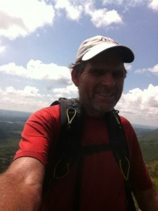
Ten down; four to go—states, that is. On another extremely humid, buggy day, I hiked out of Connecticut and into Massachusetts with a slack pack and a positive attitude. Like many other recent days, things went well early in the day, but by mid-afternoon the energy level had plummeted. Still I managed to hike 17.8 miles in ten hours over some pretty challenging terrain. Were it not for a hard rain late in the day, I could have finished at least an hour earlier. Nevertheless, I’m not complaining since I again had a room to return to on Grove St. So everything considered, I’d call the day slightly closer to John’s “magnificent” than to my preferred adjective, “miserable.”
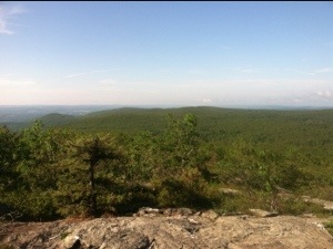
At 5:30 I started the day by cooking myself breakfast in Maria’s kitchen. After my three fried eggs, toast, and orange juice, I walked the approximately half mile back to the trail on Undermountain Rd. I then headed back into the woods at 6:10 and was immediately greeted with a climb of 1000 feet over the first 2.6 miles to Lions Head. This would be the first of several spectacular views throughout the day. After Lions Head I was faced with an additional 580 foot ascent of Bear Mountain. It’s interesting how some names are used more than once on the AT. There have been at least three Deep Gaps, for instance. Today was the second Bear Mountain. I wouldn’t classify the climb as too difficult; however the descent was a “bear.” Pardon the pun. I’m very tired as I write this.
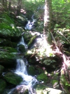
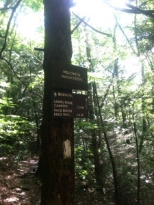
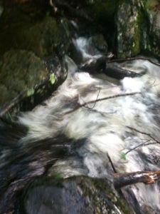
After scrambling down the steep descent, including two times when I went to the seat of my pants, I was near the CT/MA border. Just after crossing into Massachusetts, I was treated to the beauty of Sages Ravine. The trail parallels a fast running stream with multiple waterfalls for 0.3 of a mile. Having expected a bridge over the rushing waters, I must admit I was a bit disillusioned when I realized the manner to cross was over partially covered rocks. Knowing that my feet were going to get wet really didn’t matter. I just didn’t want to fall in and get swept downstream. All went well with the crossing until the last two partially submerged rocks. I had to leap from one to the other and maintain my balance. Prayers must have been being lifted up at the moment because I stuck the landing without any slippage. Breathing a sigh of relief, I looked back thankfully at the beautiful natural crossing that I had fortunately handled.
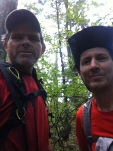
Shortly after leaving the Ravine I noticed a southbound hiker who looked familiar. Susquehanna Slim recognized me before I did him. We had first met way back in Erwin when we shared a shuttle. Slim is doing a modified flip flop due to some off trail obligations. He started a few days ago on Mt. Greylock and is hiking south to the Delaware Water Gap, where he left the trail. When he gets there, he plans to return to Greylock and keep walking north. I’ve been reading Slim’s journal occasionally, so it was an unexpected treat to see him again.
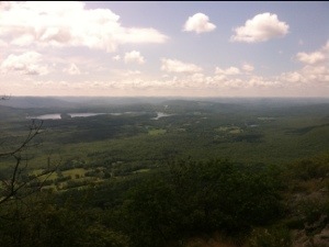
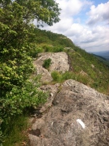
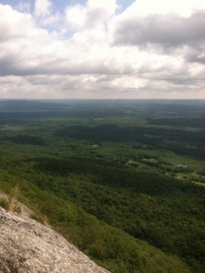
The best views of the day awaited about a mile after I saw Slim. The trail elevates to a 0.6 mile ridge walk on Race Mountain. Even I would classify the continuous vistas to the east as beautiful beyond description. Although somewhat challenging, I never felt that any part of the ridge walk could be construed as dangerous, that is unless you got too close to the edge. I made sure I didn’t. It was after Race and during the climb up Mt. Everett that I began to droop. I kept downing fluids and consuming fruit and protein bars, which finally restored some energy. I just didn’t need another climb when this one appeared. After the ascent I reached the Guilder Pond Picnic Area where someone had left several gallons of water labeled for thru hikers. With almost five miles remaining, I refilled my bottles before continuing through a swampy segment of trail. Like all recent days, the mosquitoes and various species of flies attacked relentlessly throughout the day.
As I headed toward the final difficult section of the day, the descent of Jug End, the rain began. This gave me the chance to try out my new emergency poncho. The rain also afforded me the opportunity to practice descending wet rock slabs, which would have already posed a major challenge had they been dry. Using caution, and the seat of my pants again when necessary, I managed to navigate the slippery menaces without falling. It just took time. When I reached flat trail again, I picked up the pace to arrive at MA 41 a few minutes ahead of my shuttle. After a rather tiring as well as trying day, it felt good to have this section behind me. Tomorrow more climbs and great views await as I try to stay positive while hiking the Appalachian Trail.